On the Panorama Trail over the Hasliberg


- 3:30 h
- 10.13 km
- 370 m
- 430 m
- 983 m
- 1,263 m
- 280 m
- Start: Hasliberg/Reuti
- Destination: Brünig Pass
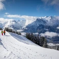
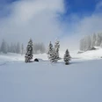
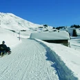
At the PostAuto terminal Hasliberg Reuti, a small street branches off eastwards from the main road uphill. From here it goes to Bidmi and Moosbielen (see Route 2). After about 300 m, turn left. Continuing uphill, the route passes through two sharp bends of the small road and then heads toward the track of the gondola lift to Mägisalp. Before going under the lift, the route leaves the road at Eggli and then leads on a prepared hiking trail with gentle ascents and descents over snow-covered meadows and through forest areas. Occasionally, a ski slope is crossed, but the peace and quiet on this route are hardly disturbed by the winter sports activities. The settlement area in Wasserwendi is characterized by the holiday village of the Swiss Travel Fund (REKA). Sixty holiday apartments are available here in a prime location in the ski area for families. The village center is correspondingly lively. After passing under the Twing–Käserstatt cable car line, winter tranquility soon returns to the hiking trail. The view from the high trail stretches far over the Brienzer Rothorn mountain range, the Brienz lake basin, and the Schwarzhorn and Rosenlaui area. At the Louwenenbach, the descent continues down to Hohfluh. After crossing the cantonal road, the path continues down past the large wooden houses of the small village, then after 200 m turns right toward Brünig Pass. Through open terrain, one reaches Schlupf and then the forest along a level path where the trail climbs again a bit. In the Bodemli area, the cantonal road is crossed again. Several huge boulders by the roadside set a primeval accent in the forest here; they were left by the Aare glacier at the end of the last Ice Age, more than 10,000 years ago. The route continues with a gentle descent toward Waldegg, where it merges with the road. After crossing the railway tracks on the road bridge, it is only a few steps north to the Brünig-Hasliberg railway station.

Good to know
Pavements
Best to visit
Directions
Equipment
We recommend the following equipment: sturdy and waterproof mountain boots, light to medium backpack, cold protection, sun protection, hiking poles, first aid kit, snacks, tea in a thermos bottle, mobile phone.
Directions & Parking facilities
Additional information
Literature
License (master data)
Safety guidelines
Nearby