Bühlberg - Laubbärgli / Schatthorn - Lookout mountain high above the Lenk


- 3:00 h
- 8.15 km
- 526 m
- 337 m
- 1,655 m
- 2,108 m
- 453 m
- Start: Lenk / Bühlberg
- Destination: Lenk / Laubbärgli
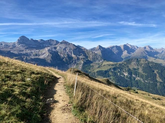
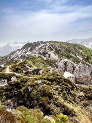
The bus runs from Lenk station up to Bühlberg. From there, the high-altitude hike leads along the west flank of the Lavey ridge, past the reforestation area between Lavey and Obere Seewele, towards Schatthore. In the morning, it is still shady on the west flank of the Lavey ridge. The higher the sun rises, the more its warmth can be felt on your back. If the Obere Seewele alp is operated, a tasty piece of alpine cheese can be bought. Over a ridge you reach the summit of Schatthore, which actually resembles more a long mountain ridge than a 'Hore'. Nevertheless, the view over the Lenk and its side valleys is wonderful. Paragliders can often be seen here, circling high above the heads of the hikers. For the descent, a portion of the path already covered must be retraced to the fork in the path. In a forest clearing lies, like on a arbor, hence the name Laubbärgli, a mountain hut. The charming little wooden house with its red-white checkered tablecloths invites you for a snack. The return to the Lenk is by a small bus directly from Laubbärgli.

Good to know
Pavements
- Asphalt (1%)Trail (31%)Path (68%)
Best to visit
- suitableDepends on weather
Directions
- Bühlberg - Obere Seewele - Schatthore - Laubbärgli
Equipment
- We recommend the following equipment: sturdy mountain boots, medium-sized backpack with hip belt, sun protection, rainwear, hiking poles, first aid kit, picnic, enough liquids, mobile phone.
Directions & Parking facilities
- Getting thereBy car via Zweisimmen to the Lenk.ParkingParking spaces on the road Lenk - Simmefäll.Public transportation
Outbound journey: By train via Zweisimmen to the Lenk. Then by bus to Bühlberg.
Return journey: By bus from Laubbärgli to the Lenk
Additional information
- Association Bernese Hiking Trails, Bern, Tel.: 031 340 01 01, E-Mail: info@beww.ch, Homepage: www.bernerwanderwege.ch
License (master data)
Author´s Tip / Recommendation of the author
- Those who wish can still descend from Laubbärgli to the Lenk!
Safety guidelines
- This route runs entirely or partly on signposted paths classified as mountain hiking trails
Map
Swisstopo hiking map 263T Wildstrubel 1:50,000