- 2:30 h
- 6.62 km
- 440 m
- 440 m
- 1,174 m
- 1,512 m
- 338 m
- Start: Gsteig
- Destination: Gsteig
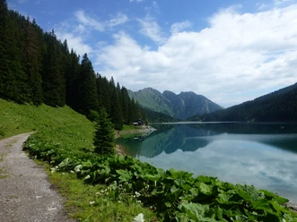
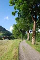
The name Gsteig was first documented in 1312 under the name Chastalet. In today’s language this means watch, defense, and refuge tower. The 7 km hike leads us from Gsteig through Rohr to Dürr and further over the Längmatte to the castle. Here we reach the highest point of the hike. The return route to Gsteig takes us through the Rotengraben and Innergsteig. Various information boards and a brochure available at the tourism office tell us interesting facts about the municipality of Gsteig-Feutersoey.

Pavements
- Asphalt (29%)Trail (31%)Path (39%)Street (1%)
Best to visit
- suitableDepends on weather
Equipment
We recommend the following equipment: light trekking shoes, light backpack, sun protection, rain jacket, pocket first aid kit, light picnic, enough fluids, mobile phone.
Directions & Parking facilities
- Parking
Parking lot south of the village center
Public transportationRound trip: by train to Gstaad. Then by bus to Gsteig, Post. Literature
Brochure about the trail available at the tourism office in Gsteig
License (master data)
Map
Swisstopo hiking map T263 Wildstrubel 1:50,000