- 5:40 h
- 12.46 km
- 1,200 m
- 1,200 m
- 1,111 m
- 2,248 m
- 1,137 m
- Start: Saxeten
- Destination: Saxeten
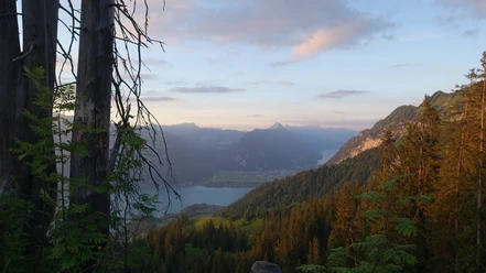
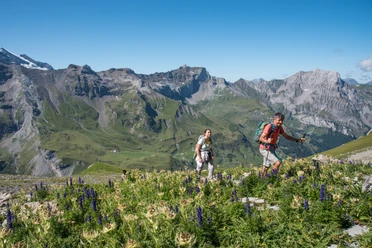
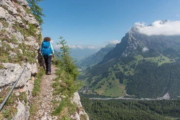
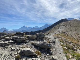
Who says that the Morgenberghorn must necessarily be climbed in the morning? It is also excellently suited for an autumn afternoon tour and thus offers hikers a special treat in the form of an evening summit experience. From the Postbus terminus Saxeten, follow the small road uphill along the valley for a few minutes. Then a well-developed mountain path branches off uphill and leads alternately through shady forest and fragrant mountain meadows. While gradually gaining altitude, the view opens more and more over the entire Brienz Lake basin. Passing the huts of Mittelberg, you reach the Rengglipass, the transition from the Saxet valley to the Suldtal. The distinctive spikes of the Dreispitz crown the ancient valley enchantingly. From the pass summit, the path to the Morgenberghorn branches off to the north. The ascent goes upwards in partly very steep sections. After an exposed ridge, some equally exposed passages follow on the western flank of the peak. A wire rope along the slope helps with the traverse. Nevertheless, these key sections require absolute sure-footedness and a head for heights. After a final ascent on a pleasant grassy path, you will see the standard with the Swiss and Bernese coats of arms on the summit – and immediately the overwhelming panoramic view captivates you. Far to the north, the gaze sweeps over Lake Thun and Lake Brienz, over Niederhorn, Hohgant, and the range of Augstmatthorn and Brienzer Rothorn, while to the south the massive rock formations of the Schwalmere and behind them the Bernese high Alps fascinate. The return to the valley is along the same route.

Pavements
- Asphalt (19%)Trail (4%)Path (77%)
Best to visit
- suitableDepends on weather
Directions
- Saxeten - Rengglipass - Morgenberghorn - Rengglipass - Saxeten
Equipment
- We recommend the following equipment: sturdy mountain boots, medium-sized backpack with hip belt, sun protection, rainwear, hiking poles, first aid kit, picnic, sufficient fluids, mobile phone.
Directions & Parking facilities
- Public transportationOutbound and return trip: By train via Interlaken Ost to Wilderswil. From Wilderswil by bus to Saxeten.
Additional information
- Association of Bernese Hiking Trails, Bern, Tel.: 031 340 01 01, Email: info@beww.ch, homepage: www.bernerwanderwege.ch
License (master data)
Safety guidelines
This route runs wholly or partly on alpine hiking trails, sure-footedness and a head for heights are absolute prerequisites.
Map
- Swisstopo hiking map 1:50,000 254T Interlaken