Iffigenalp - Simmenfälle / Magical Waterfall - "D'Sibe Brünne"


- 3:45 h
- 10.31 km
- 500 m
- 970 m
- 1,105 m
- 1,999 m
- 894 m
- Start: Lenk/Iffigenalp
- Destination: Lenk/Simmenfäll
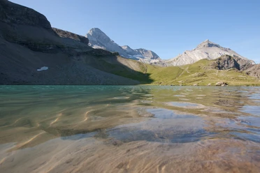
From Iffigenalp, follow the alpine road for 500 m towards Lenk. At the large boulder at P.1548, turn right onto the mountain hiking trail. After crossing the Iffigbach, proceed over alpine pastures on a path uphill to Alp Ritz. Here you can refill your water bottle at the fountain or even buy cold and warm drinks or alpine products. Continuing on an alpine path, you soon reach the beautiful high plateau of Langermatte, from where you have a wonderful view of the nearby Laufbodehore and the Wildstrubel massif. Shortly before the Langermatte alpine hut, the path branches off towards Oberlaubhore. Over alpine pastures, gently hike uphill until the initially broad mountain ridge narrows into a ridge (but never exposed). Upon reaching P.1999, there is a splendid view towards Wildstrubel, but those seeking a prime spot with a view of the Simmental continue to P.1969, where the summit cross of Oberlaubhore is located.
Return the same way to the junction at Alp Langermatte. Passing the alpine hut (possible to stop), the path goes slightly downhill. After Alp Langer, you enter the shady forest which you leave again at P.1449. On a flat alpine path, follow alongside the Trüebbach (which flows into the Simme) to the second bridge. Here, keeping right, go to Alp Rezliberg and the Siebenbrünnen. The small detour directly to the Siebenbrünnen, the "birthplace" of the Simme, should not be missed. The path descends on an alpine road to the junction at Barbarabrücke, where the Simme impressively plunges over a rock ledge. Crossing the bridge guarantees a refreshing spray. The subsequent descent to the bus stop at the Simmenfäll restaurant for safety reasons does not follow the Simme (see note) but follows the alpine road. The hike is also suitable for doing in reverse.

Good to know
Pavements
Best to visit
Directions
Equipment
Directions & Parking facilities
Outbound: from Lenk station by bus to Iffigenalp
Return: by bus from the Simmenfälle restaurant to Lenk station
Additional information
Literature
Bernese Oberland hiking book by Bernese Hiking Trails
License (master data)
Safety guidelines
Map
Swisstopo hiking map: 263T Wildstrubel
Nearby

