- 2:25 h
- 8.76 km
- 70 m
- 590 m
- 1,065 m
- 1,584 m
- 519 m
- Start: Lenk / Iffigenalp
- Destination: Lenk in Simmental / Station
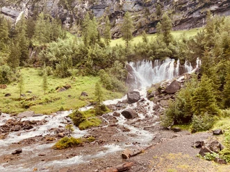
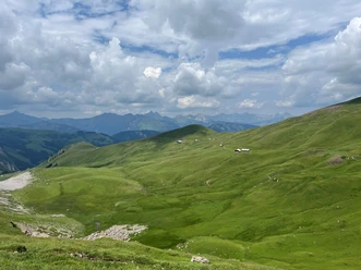
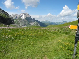
The starting point of the hike is the Iffigenalp at almost 1600 m above sea level. From the post bus terminus at the mountain house, you hike steadily downhill towards Lenk. A wonderful hiking trail follows the wild stream. Here and there, the water disappears behind rocks only to reappear shortly after, rushing closer to the path. Above the Iffigfall, the path leaves the stream and leads in a wide arc down to the foot of the waterfall. Here you can see the water impressively plunge down. An incredible power becomes tangible. The plants around the waterfall are lush green. The water droplets on the meadow sparkle as if small crystals had been magically scattered. Once you've had enough to look at, you can continue the hike along the Iffigbach. Shortly after, you pass Pöschenried and then reach two inviting rest areas. Almost at the end of the hike, shortly before Lenk, it is recommended to plan a stop at the Lenkerseeli. The small lake is a popular place to linger.
Background: The Iffigfall is considered one of the most beautiful waterfalls in the Bernese Oberland and beyond. With a drop height of more than 100 meters, the waterfall is a spectacle that impressively expresses the power and beauty of nature and water. The Iffigbach originates at the back of the Iffigtal. After about eight kilometers, it flows into the Simme at Lenk. The unspoiled, natural stream with its gorge-like sections and the Iffigfall is part of the large Gelten-Iffigen nature reserve.

Pavements
- Asphalt (12%)Path (41%)Trail (22%)Gravel (15%)Street (10%)
Best to visit
- suitableDepends on weather
Directions
- Iffigenalp – Iffigfall – Inderi Ey – Lenkerseeli – Lenk i. S.
Equipment
We recommend the following equipment: Light trekking shoes, light backpack, sun protection, rain jacket, first aid kit, light picnic, sufficient fluids, mobile phone.
Directions & Parking facilities
- Public transportationOutbound: by bus to Lenk / Iffigenalp
Return: by train from Lenk
Additional information
- Berner Wanderwege, 031 340 01 01, info@beww.ch, bernerwanderwege.ch
Literature
License (master data)
Author´s Tip / Recommendation of the author
- The waterfall has its charm in every season but is particularly impressive when huge amounts of water powerfully plunge during snowmelt. In the small basin at the foot of the Iffigfall, the energy of the splashing water collects. Furthermore, the AlpKultur playground Lenkerseeli with alpine hut, play equipment, fire pits, Strubeli ride, and much more invites you to discover and have fun – an ideal excursion destination for the whole family.
Safety guidelines
This route runs exclusively on marked paths of the hiking trail category.
Map
- swisstopo hiking map: 263T Wildstrubel