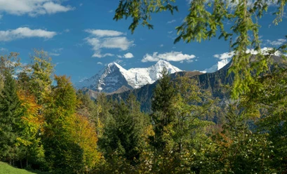
On Beatenberg, the sunny terrace of the Bernese Oberland


- 4:15 h
- 10.74 km
- 600 m
- 600 m
- 1,202 m
- 1,655 m
- 453 m
- Start: Beatenberg/Waldegg
- Destination: Beatenberg/Waldegg
The hike is located on the municipal territory of Beatenberg. The first documented mention dates back to 1230. The name and coat of arms come from Beatus, who, according to a legend, drove a dragon out of the Beatus cave. The Beatusweg, an experience trail about the legend, explains the story with various stations. From the starting point of the hike, you follow this experience trail for the first kilometer towards Rischerebödeli, passing among other things a stone circle and a large play castle for children. After crossing the Sundgraben at Rischere, you reach a resting place. Here, follow the signpost towards Burgfeld. Uphill across meadows and through forest to the Gemmenalphorn junction, where you continue towards Burgfeld. Later you reach the access road to Underburgfeld. After leaving the forest, a comprehensive view opens up.
From Underburgfeld begins the descent towards the two viewpoints Bire and Känzeli. At the next signpost, turn left and follow the indication Bireflue. Along rock ledges, partly exposed, the hike now proceeds to the Bire viewpoint. Later, follow the signpost Burgfeld, and ascend briefly before then following the rock ledges left towards Känzeli. At the next fork, take the route towards Beatenberg and Spirenwald and descend to the access road. On this, the hike continues past a resting place towards Beatenberg/Waldegg. At the next signpost after the forest near Bödeli, take the path right across the meadow and through the forest. After crossing the Sundgraben, you return on the already walked path to Beatenberg Waldegg.

Good to know
Pavements
Best to visit
Directions
Equipment
Directions & Parking facilities
Outbound: By train to Interlaken West, then by bus to Beatenberg, Waldegg
Return: By bus from Beatenberg, Waldegg to Interlaken West, then by train
Additional information
License (master data)
Safety guidelines
This route runs exclusively on marked paths of the hiking trail category.
Map
Swisstopo hiking map 254T Interlaken 1:50,000
Nearby


")
")
")
Download GPX file