On old pack trail from Gadmen to Steingletscher


- 3:45 h
- 9.17 km
- 763 m
- 127 m
- 1,169 m
- 1,951 m
- 782 m
- Start: Gadmen
- Destination: Steingletscher
The Susten Pass was already crossed by the Romans, as finds of coins prove. For trade it had a subordinate importance and was mainly an alternative route when the Grimsel and Gries passes were not passable.
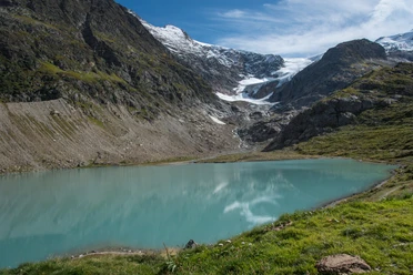
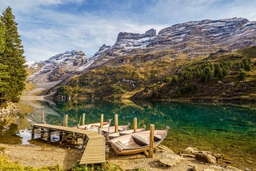
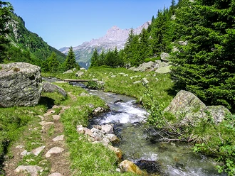
The old pack trail is today a wonderful hiking route away from the road. The masonry and paved pack trail is still partly preserved, but often a simple natural path leads through a primeval gneiss landscape with rocky outcrops, streams, and moors. Sometimes the path squeezes through narrow gaps, then it crosses open pastures with impressive views of high peaks and the huge limestone cliffs of the Gadmerflue. The vegetation also changes with the ascent. While around Gadmen dense forest and bushes still prevail, towards the Steingletscher mainly low shrubs like blueberries and alpine roses thrive. At the end a detour to the Steisee is worthwhile, which can be reached by a road or various animal tracks.

Good to know
Pavements
Best to visit
Directions
Gadmen (1206 m) – Eynollen – Wyssenmad – Steingletscher (1863 m). Part of the ViaBerna, Hiking Route No. 38.
Equipment
Mountain hiking equipment
Directions & Parking facilities
Train to Meiringen and post bus to Gadmen, Post. Depending on the timetable, from Meiringen with the small MIB railway to Innertkirchen Grimseltor and there transfer to the post bus.
Post bus from Steingletscher, Susten back to Meiringen or Innertkirchen.
Additional information
Alpin Center Susten Pass, 033 975 12 22, sustenpass.ch; Haslital Tourism, 033 972 50 50, haslital.swiss
Literature
Sabine Joss / Fredy Joss: The 77 most beautiful high and panoramic hikes. ISBN 978-3-03865-074-4, Rothus Medien, Solothurn, www.wandershop-schweiz.ch
Sabine Joss / Fredy Joss: The 77 most beautiful hikes to mountain railways and bus. ISBN 978-3-03865-104-8, Rothus Medien, Solothurn, www.wandershop-schweiz.ch
Sabine Joss / Fredy Joss: The 88 most beautiful summit tours in Switzerland. ISBN 978-3-03865-071-3, Rothus Medien, Solothurn, www.wandershop-schweiz.ch
More about Fredy Joss: www.fredyjoss.ch
License (master data)
Author´s Tip / Recommendation of the author
The further ascent to the pass height offers even more views, but also more traffic noise, as the path now runs very close to the road. 1 ¼ h.
Safety guidelines
Difficulty T2
Map
Map scale 1:50 000, 255T Susten Pass.
Nearby