On the Way of St. James to the Beatus Grotto


- 4:00 h
- 13.22 km
- 260 m
- 260 m
- 558 m
- 726 m
- 168 m
- Start: Merligen
- Destination: Interlaken
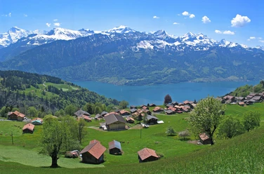
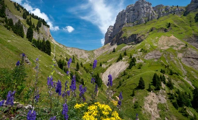
From the bus or boat station Merligen, ascend towards Justistal. At the top of the village, turn right onto the pilgrimage path. Through forest or at its edge, it leads to Beatenbucht/Fischbalme and, after crossing the Beatenberg railway track, up to the viewpoint on a rock nose. The view down to the lake below and the impressive mountain world is unique.
The large quarry in Balmholz is bypassed along the slope. First on a flat path, then slightly ascending, you reach the cave park at the Beatus Caves. Visiting the caves (entry fee) provides an interesting insight into the underground erosion activity and dripstone formation by water. From the former pilgrimage sanctuary, only some wall remains and the pilgrimage bell are left.
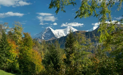
At the foot of a rock band, the pilgrimage path continues to Sundlauenen, which belongs to the municipality of Beatenberg. Initially heading towards Ländte, but halfway turning to the forest edge and crossing the delta piled up from the Sundgraben (a popular recreational area). Follow the street only briefly before a quiet forest path leads past the former Beatus bath, today Manorfarm, to Neuhaus. From here, continue through the Neuhaus-Weissenau nature reserve protected since 1943. This narrow raised bog area is a preferred habitat and breeding ground for many water bird species. At the end of the renatured promenade stand the ruins of the former water castle Weissenau. Along the Aare riverbank, you reach the nearby Interlaken West station via Unterseen.

Good to know
Pavements
Best to visit
Directions
Merligen - Beatus Caves - Neuhaus - Weissenau - Interlaken
Equipment
We recommend the following equipment: light trekking shoes, light backpack, sun protection, rain jacket, pocket pharmacy, light picnic, sufficient fluid, mobile phone.
Directions & Parking facilities
Depart with STI Bus No. 21 from Thun or Interlaken to the Merligen, Beatus stop
Return trip with STI Bus No. 21 from Interlaken West station
Additional information
Bernese Hiking Trails Association, Bern, Tel.: 031 340 01 01, E-mail: info@beww.ch, Homepage: www.bernerwanderwege.ch
Literature
Hiking suggestion from the hiking book Lake Thun - Frutigland, hiking book series of the Bernese Hiking Trails
License (master data)
Author´s Tip / Recommendation of the author
Outbound and return travel by STI bus from Thun or Interlaken
Safety guidelines
This route runs entirely on hiking paths.
Map
Swisstopo hiking map 1:50,000 254T Interlaken
Nearby


")
")
