- 6:35 h
- 18.56 km
- 1,103 m
- 1,103 m
- 1,104 m
- 2,062 m
- 958 m
- Start: Grön Parking Lot
- Destination: Grön Parking Lot
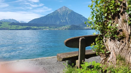
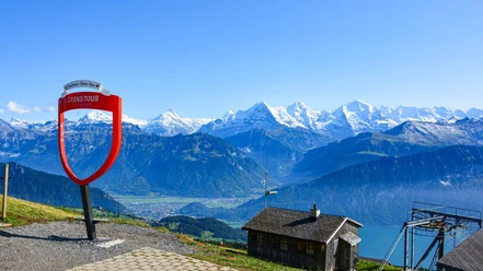
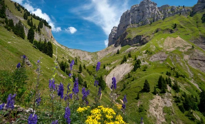
From the Grön parking lot, hike through the tranquil Justistal valley. From Hindersberg to Seefeld, the path becomes steeper and opens views of the pyramid-shaped Niesen. After reaching Alp Seefeld, the red/white marked mountain trail branches off to the right, over stone slabs lined with mountain pines to Gemmenalphorn. At the summit, you will find a top-class panoramic view. Continue hiking over Burgfeldstand to Niederhorn. Along the way, you may occasionally observe ibex, chamois, or marmots. The return route on foot leads you via Waldbrand to the starting point or by cable car to Beatenberg and back to Grön.

Best to visit
- suitableDepends on weather
Directions
Grön – Büffelboden – Hindersberg - Alp Seefeld – Gemmenalphorn – Burgfeldstand – Niederhorn (with cable car to Beatenberg) via Waldbrand back to Grön.
Equipment
We recommend sturdy footwear as well as sun and rain protection
Directions & Parking facilities
- Getting there
By car from Bern via the A6 highway to Thun Nord, continue towards Gunten, turn left towards Sigriswil. Then continue towards Beatenberg to the parking lot Grön (approx. 35 minutes). From Interlaken towards Beatenberg, continue towards Sigriswil to the parking lot Grön (approx. 35 minutes).
ParkingFree parking at Grön directly at the start
Public transportationPublic transport from Thun to Sigriswil village with bus line 25. Hike to the starting parking lot Grön. Approx. 1 hr 45 min, 5.5 km. Or from Thun or Interlaken West with bus line 21 to the Beatenbucht bus stop and via funicular railway to Beatenberg. Hike to the start, parking lot Grön: Approx. 1 hr, 3.7 km.
PostBus line 101 from Interlaken West to Beatenberg station. Hike to the start parking lot Grön: Approx. 1 hr, 3.7 km
Additional information
- Sigriswil-Gunten Tourism
Info-Center Gunten
Seestrasse 81
3654 Gunten
Tel. +41 33 251 11 46
gunten@thunersee.ch
www.sigriswil-tourismus.chInterlaken Tourism
Marktgasse 1
3800 Interlaken
Tel.: +41 33 826 53 00
mail@interlaken.swiss
www.interlaken.swiss/hikingDo you want to discover even more hikes?
Learn more about the various hiking opportunities in the Bernese Oberland. License (master data)
Author´s Tip / Recommendation of the author
The route can also be done in the opposite direction. For the ascent, you can use the group cable car from Beatenberg to Niederhorn. Tip: Watch the ibex around Gemmenalphorn.
Safety guidelines
This route runs on signposted trails of the Bernese hiking trails.