Silleren - Hahnenmoos, a hiking paradise


- 4:50 h
- 14.17 km
- 453 m
- 1,200 m
- 1,262 m
- 2,079 m
- 817 m
- Start: Sillerenbühl
- Destination: Adelboden
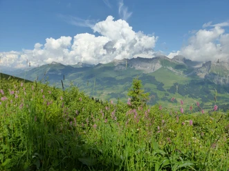
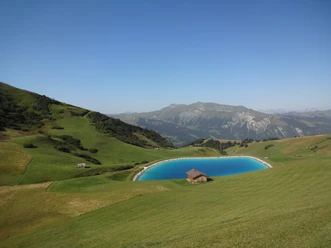
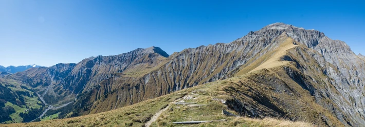
Along the Niesen chain you can see as far as the Thun lake area. On the opposite side of the valley, Elsighorn, Bunderspitz, Chlyne and Gross Lohner rise up, and in the south Wildstrubel and Wildhorn border the horizon. Down the alpine road into the Grats valley and on a wide gravelled high trail, always staying on the ridge, into the eastern flank of the Lavey ridge. From Vordersillere the path leads with gentle ups and downs over flower-rich grass slopes and through eroded channels to the mountain hotel at Hahnenmoospass (mountain station of the Hahnenmoos cable car). Wonderful view over the raised bog basin towards the Wildstrubel-Wildhorn massif! The path now goes almost level into the flank of the Regenboldshorn to the Schatthaus Ufem Blatti. Fields of alpine roses line the path, which again reaches the ridge at Luegli. The descent to the huts of Bütschi leads between massive rock blocks and through the alpine hollow Lurnig to the Troneg ridge and downstream to another lookout highlight, the Chuenisbärgli. Very steep it goes down into the valley floor and on asphalt over the Steinigi Bridge back to Adelboden.

Good to know
Pavements
Best to visit
Directions
Equipment
Directions & Parking facilities
Arrival and return: by train to Frutigen. Then by bus to Adelboden Mineralquelle
Additional information
Literature
Hiking suggestion from the hiking book Thunersee - Frutigland, hiking book series of the BWW
License (master data)
Safety guidelines
Map
Swisstopo hiking map 1:50,000 263T Wildstrubel
Nearby
Download GPX file