Sledding trail Faulhorn - Grindelwald (The longest sledding run in Europe)


- 5:00 h
- 17.74 km
- 560 m
- 1,600 m
- 1,116 m
- 2,666 m
- 1,550 m
- Start: Hiking from First (2166 m asl), sledding from Faulhorn (2680 m asl)
- Destination: Grindelwald (1034 m asl)
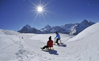
From the First mountain station, it goes on the wide winter hiking trail with gentle ups and downs (which can be sledded) to the Bachsee. At the end of the Bachsee, hardly visible in winter, the path becomes noticeably steeper. Once the Gassenboden pass height is reached, you can optionally still climb the last 120 altitude meters to the summit of the Faulhorn. The sled can be pulled along up to about 60 m below the summit – up to there the hiking trail is groomed. From the summit of the Faulhorn you have a magnificent view of Lake Brienz and beyond towards the Swiss Midlands. From the pass height, the sled descent begins, first harmless. But soon it goes into the first sharp curve. Short steep sections repeatedly make the sled accelerate properly, so you should be sure to control the braking and also stop on the roadside when stopping, not on the piste. From Bussalp to Grindelwald Gaggi Säge the route runs on the road where the bus (forbidding cars) drives. The route is less demanding here, but caution is required as parts go through the forest.
Bernd Jung

Good to know
Pavements
Best to visit
Directions
Grindelwald First – Bachsee - Faulhorn – Bussalp – Grindelwald Gaggi Säge
Equipment
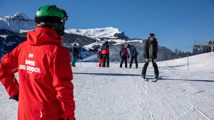
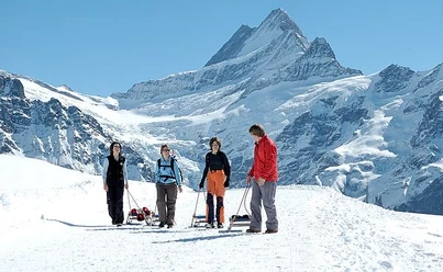
Sled, good footwear, weather-appropriate clothing, gloves, hat and helmet, provisions including hot drink, mobile phone, emergency number.
Directions & Parking facilities
By car via Interlaken to Grindelwald to the valley station of the First cable car.
Parking lots at the valley station or at the Pfingstegg cable car. Additional parking in the village center.
By train from Interlaken to Grindelwald. Then on foot or by post bus to the valley station of the First cable car.
Additional information
Grindelwald Tourism
Dorfstrasse 110
P.O. Box 124
3818 Grindelwald
Tel. +41 (0)33 854 12 12
touristcenter@grindelwald.ch
License (master data)
Author´s Tip / Recommendation of the author
Sled rental available
Safety guidelines
Everyone is responsible for their own actions and behavior
Map
swisstopo national map 1229 Grindelwald 1:25,000
swisstopo hiking map 3323T Jungfrau Region 1:33,333
Nearby
")