Stockhorn Adventure Trail


- 2:40 h
- 6.94 km
- 313 m
- 313 m
- 1,596 m
- 1,798 m
- 202 m
- Start: Chrindi (Stockhornbahn middle station)
- Destination: Chrindi (Stockhornbahn middle station)

Berner Wanderwege
Good to know
Pavements
- Path (87%)Trail (12%)Gravel (1%)
Best to visit
- suitableDepends on weather
Directions
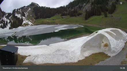
- The adventure trail leads from the middle station “Chrindi” or from the Stockhorn summit along existing hiking trails over the Oberstocken alp around the two mountain lakes and the Cheibenhorn back to the starting point.
Equipment
We recommend the following equipment: Light trekking shoes, light backpack, sun protection, rain jacket, pocket first aid kit, light picnic, sufficient fluids, mobile phone.
Directions & Parking facilities
- Getting thereBy car via Wimmis to Erlenbach to the Stockhornbahn valley station.Public transportationArrival and return: By train via Spiez to Erlenbach. On foot to the Stockhornbahn valley station. Then continue to the Chrindi middle station.
Additional information
License (master data)
Safety guidelines
The themed trail runs on signposted trails categorized as hiking and mountain hiking paths
Map
- Swisstopo hiking map 253T Gantrisch 1:50,000
Nearby





Download GPX file