Sytiberg Trail

5.53 km long
Round trip
Difficulty: easy
Condition: very easy
Great panorama
Jogging
  • 0:57 h
  • 5.53 km
  • 146 m
  • 146 m
  • 567 m
  • 712 m
  • 145 m
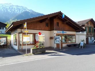
  • Start: Tourism Office Bönigen
  • Destination: Tourism Office Bönigen
From the lakeshore in Bönigen through the historic houses path, over the scenic ascent to Sytiberg, further through the dense forest, back over the green fields and through the village back to the lake.

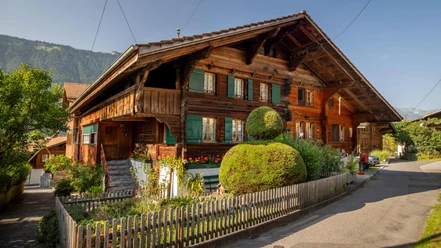
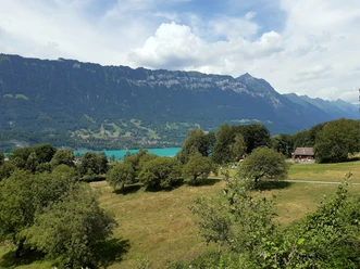
 From the lakeshore in Bönigen, it goes through the historic houses path and further on the forest path over the scenic ascent to Sytiberg. From here, it goes through the dense forest, past a fire pit to the Aenderberg forester's house, steadily slightly downhill. Along a small brook and past a farm over the green fields. Shortly before returning to the village, there is another slight ascent to the church before it goes through the village back to the lake. A hidden gem for everyone who enjoys peaceful and sparsely populated sections while jogging.

Interlaken Tourismus

Good to know

Pavements

Street
Trail

Best to visit

suitable
Depends on weather

Directions

From Bönigen See along Seestrasse towards the village, turn left into Oberlandstrasse and then immediately right into Endweg. Continue straight into Höhenrain and turn left at the end into Brunngasse. Up to this point, you jog through the old village part of Bönigen with the historic houses. From Brunngasse, go straight up over the bridge to Panoramaweg. From here, there is an ascent over Oberallmi to the Oberallmi signpost. From there, follow the signpost towards Sytiberg. On this route, it goes steadily uphill, with views over the Bödeli to Niesen and over Lake Brienz. Upon reaching Sytiberg, follow the signpost towards Aenderbergbrügg and pass a barbecue area as well as the Aenderberg forester's house. Once you reach the flat area down below, follow the signpost towards Acherhubel over the fields past the farm. From the farm, continue over the fields along the old church path, past the church and down the Kirchgasse on the left. From there, follow the main road through the center of Bönigen back to the lake.

Directions & Parking facilities

Motorway exit Interlaken Ost / Bönigen if coming from Bern, Thun.
Motorway exit Bönigen if coming from Brienz.

Parking spaces (paid) as well as a toilet are located behind the Hotel Seiler au Lac in Bönigen.

By train to Interlaken Ost. From there, take bus 103 to the "Bönigen See" station. The bus runs every 30 minutes towards Interlaken or every hour towards Iseltwald.
To return to Interlaken, take bus number 103 from the "Bönigen See" bus stop around the corner right at the lake.

Additional information

Bönigen-Iseltwald Tourism
Seestrasse 6
CH-3806 Bönigen
T 0041 33 822 2958
mail@boenigen-iseltwald.ch
www.boenigen.ch/tourismus

License (master data)

Author´s Tip / Recommendation of the author

  • A hidden gem for everyone who enjoys peaceful and sparsely populated sections while jogging.
  • At the end of the route, Lake Brienz awaits for a refreshing dip.
  • Parking spaces (paid) as well as a toilet are located behind the Hotel Seiler au Lac in Bönigen.

Safety guidelines

On the way back across the fields, there is a shooting range. When in operation, part of the path is closed, so be sure to follow the local signs and return to the village via the asphalt road.

Nearby

Address

Sytiberg Trail
Bönigen