- 2:50 h
- 8.35 km
- 243 m
- 750 m
- 1,796 m
- 2,404 m
- 608 m
- Start: First
- Destination: Bussalp
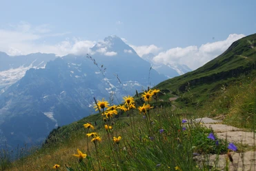
At the First mountain station, anyone who wishes can first test their altitude resistance by taking the short but airy walk over the Cliff Walk. Mostly on a gravel road, one then hikes to the Bachalpsee. The approximately 100 meters of ascent to the beautifully situated mountain lake are hardly noticeable due to the distance of about 3 km. The Bachalpsee consists of two lakes, between which one can enjoy a break very well on the small meadow patches. The view across the smaller, front lake towards the Bernese Alps with the striking Schreckhorn promises a wonderful photo motif.
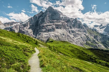
Passing the right shore of the small lake, we turn right at the trail junction P.2259 and thus reach, with only a slight altitude difference, the trail junction Hirrleni/Uf Spitzen. Keeping right, we follow the ridge to Fernandeshitta at P.2401, a small shelter that serves well as a rest stop. The path now swings into the southern flank of Reeti and initially winds through rockfall debris to the trail junction Feld at P.2164. Then the wide basin is crossed over the Büössalpbach to the trail junction P.2089. Here we follow Höhenweg 2200 and descend on the alpine meadows keeping left, crossing several streams, to the bus stop and restaurant Bussalp.

Pavements
- Trail (30%)Path (69%)Street (1%)
Best to visit
- suitableDepends on weather
Equipment
- We recommend the following equipment: sturdy mountain boots, medium-sized backpack with hip belt, sun protection, rainwear, hiking poles, first aid kit, picnic, sufficient fluids, mobile phone.
Directions & Parking facilities
- Public transportation
Outbound journey: about 10 minutes on foot from Grindelwald train station to the First cable car
Return journey: by bus from Bussalp to Grindelwald train station
Additional information
- Bernese Hiking Trails Association, Bern, Tel.: 031 340 01 01, Email: info@beww.ch, Website: www.bernerwanderwege.ch
Literature
- Hiking guide Bernese Oberland of the Bernese Hiking Trails
License (master data)
Safety guidelines
- This route runs entirely or partly on mountain hiking trails.
Map
- Swisstopo hiking map 254T Interlaken 1:50,000