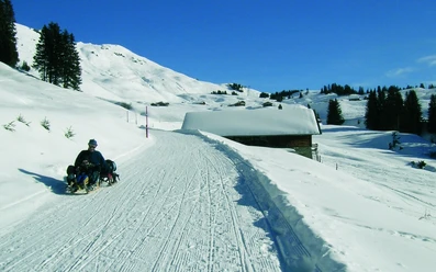
With the sled to the viewpoint of the Haslital

- 1:30 h
- 3.54 km
- 338 m
- 3 m
- 1,053 m
- 1,391 m
- 338 m
- Start: Hasliberg/Reuti
- Destination: Hasliberg/Winterlicken
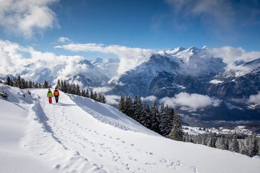
From the Reuti terminus of the Brünigpass–Hasliberg postal bus line, take the small road that ascends eastward away from the cable car and ski area. Initially, it still runs through a settlement area, so occasional cars must be expected. Soon, however, open terrain is reached, so that you can now freely enjoy the magnificent view of the upper Haslital towards the Grimsel area, the Rosenlaui area and the Aare valley floor with Meiringen.
Ignoring the yellow hiking trail junctions once, you remain consistently on the small road and steadily gain altitude. After some wide bends, the Obri Schletter junction (to Bidmi 1 h) is reached. From then on, mountain forest and alpine pastures alternate. With increasing altitude, the panorama also widens until you reach the destination Winterlicken. Here a rest and an extensive panoramic view from the Grimsel area over the Urbachtal, Engelhörner, Rosenhorn, Rosenlaui area, Schwarzhorn, Lake Brienz, and Rothorn chain is worthwhile. Returning to Hasliberg Reuti is possible either on foot or in a fast downhill ride on the sled.

Good to know
Pavements
- Street (80%)Asphalt (20%)
Best to visit
- suitableDepends on weather
Directions
- Hasliberg/Reuti - Schletter - Winterlicken
Equipment
- We recommend the following equipment: sturdy and waterproof mountain boots, light to medium backpack, cold protection, sun protection, hiking poles, pocket pharmacy, snacks, tea in a thermos bottle, mobile phone.
Directions & Parking facilities
- Public transportation
Getting there: By train to Meiringen and from there with the Godelbahn to Hasliberg Reuti.
Additional information
- Bern Hiking Association, Bern, Tel.: 031 340 01 01, E-mail: info@beww.ch, Homepage: www.bernerwanderwege.ch
License (master data)
Safety guidelines
- This route runs on marked winter hiking trails.