- 2:40 h
- 7.11 km
- 480 m
- 550 m
- 1,170 m
- 1,661 m
- 491 m
- Start: Lauenen
- Destination: Gsteig
A shingled church (without electric light but with underfloor heating!), magnificently decorated house facades, and traditional inns illustrate why Lauenen is rightly listed in the Federal Inventory of Protected Localities. Here, tourism has only minimally influenced the beauty of the matured village. The valley was presumably settled from Valais via the now no longer used Gelten Pass west of the Wildhorn.
Together with Saanen and Gsteig, Lauenen belonged to the Kastlanei Vanel of the County of Gruyère and fell to the city republic of Bern in 1555.
From the center of Lauenen one initially follows the main road about 500 m downhill. The view of the imposing valley end with the mountain peaks around the Wildhorn is magnificent. At the Louwibach, a footpath branches off downhill, merging into a forest road. This leads up to the transformer station on the Schindelbode. From the uppermost farmstead, follow the grassy trail to the height of the scenic hilltop, where there is a magnificent view back over the village and its church. The steadily ascending meadow path crosses the slope to the forest and follows it past the saddle near the ski lift mountain station to the bridge over the Sattelgrabe.
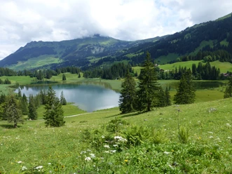
Along the way there is a nice view back to the green pyramid of Louenehore, the rocky Giferspitz, and the wide green slopes of the Trütlisberg pass. Beyond the brook, on the forest road, take the footpath that climbs steeply upwards to bypass the swampy terrain. In a light forest with a few switchbacks into the elongated Chrine nestled between Höhi Wispile and Walliser Wispile. Beautiful view into the valley of Gsteig, which is dominated by the Oldenhorn, and into the wild mountain region west of the Sanetsch Pass.
From the pass height down to the uppermost alpine hut, where a good alpine road begins that descends not too steeply at Ussere Saaligraben, then sometimes changes to a path along the wooded Innere Saaligraben and leads down to the meadows in the Rohr. An asphalt road finally leads over the Saane to the valley road, which is reached near the center of Gsteig. The core zone of Gsteig is also listed in the Federal Inventory of Protected Localities.

Pavements
- Street (6%)Asphalt (15%)Path (55%)Trail (24%)
Best to visit
- suitableDepends on weather
Directions
Lauenen - Sattel - Chrine - Saaligraben - Gsteig
Equipment
We recommend the following equipment: light trekking shoes, light backpack, sun protection, rain jacket, first aid kit, light picnic, sufficient fluids, mobile phone.
Directions & Parking facilities
- Public transportation
Outbound journey: by train to Gstaad. Then by bus to Lauenen.
Return journey: by bus from Gsteig to Gstaad station
Additional information
Association Bernese Hiking Trails, Bern, Tel.: 031 340 01 01, email: info@beww.ch, homepage: www.bernerwanderwege.ch
Literature
Hiking suggestion from the hiking book Pass routes in the Bernese Oberland, hiking book series of the Bernese hiking trails.
License (master data)
Safety guidelines
This route runs entirely on hiking trails.
Map
Swisstopo hiking map 1:50,000 263T Wildstrubel