- 5:20 h
- 14.82 km
- 750 m
- 1,240 m
- 565 m
- 1,673 m
- 1,108 m
- Start: Innereriz
- Destination: Merligen
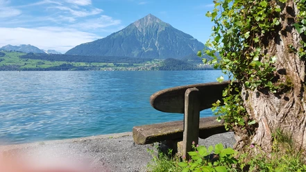
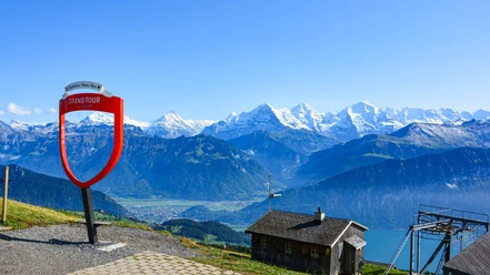
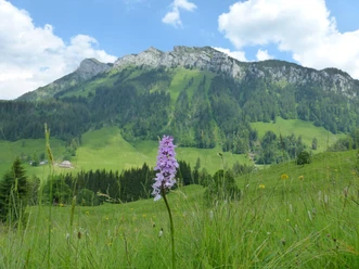
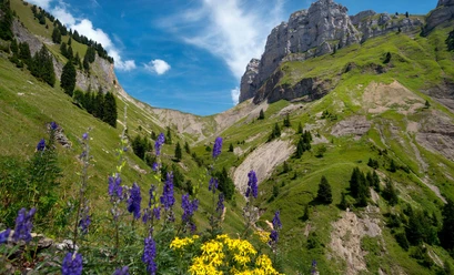
From the bus terminus Innereriz/Säge, cross the valley floor to Geissegg on the street branching off to the right. The end of the valley is impressively marked by the rock bands of the Hohgant to the east and the Solflue to the south. Now a somewhat rough path leads steeply upwards on the western flank of the Sulzigraben through forest and over pastures via Under Schöriz to the cottage of Ober Schöriz. From the foot of the Burst massif, at point 1470, a rough path crosses several ravines and leads directly up to the visible mountain pass. Fascinating is the peculiar rock layering of the Sieben Hengste with dark molasse at the lower part and the light limestone above. The Sichle truly embodies its name. The saddle was glacially expanded into a trough by a side arm of the Aare glacier during the ice age. Magnificent views southward to the Niesen and the Frutig valley and northward over the forested Eriz to the Honegg. Crossing scree ravines, through sparse woodland and over open alpine pastures, the pass path runs along the right side of the valley down to the beautifully located Oberhofner. An asphalted alpine road leads into the valley floor of the Justistal to Hinterstberg. The valley, flanked on both sides by mighty cliff bands, is named after Saint Justus, who is said to have lived here as a hermit. The gently sloping valley floor follows close to the Grönbach creek past Gross Mittelberg downstream. After passing through the wooded rockfall barrier at Püfelberg, one reaches the decorated cheese storage buildings of Spicherberg, where the much-visited cheese festival takes place at the end of September, and the Grön hut. Twice the forest road crosses the creek before it descends along the right valley flank to the Gütsch. Here one enjoys a wonderful view over Lake Thun and the balanced mountain pyramid of the Niesen. The path resumes descending along the stream to Merligen.

Pavements
- Asphalt (9%)Trail (66%)Path (25%)
Best to visit
- suitableDepends on weather
Directions
- Innereriz - Ober Schöriz - Sichle - Grön hut - Merligen
Equipment
We recommend the following equipment: sturdy mountain boots, medium-sized backpack with hip belt, sun protection, rainwear, trekking poles, pocket first aid kit, picnic, sufficient fluids, mobile phone.
Directions & Parking facilities
- Public transportation
Outbound journey: From Thun station by STI bus to Eriz, Säge
Return journey: From Merligen, Beatus by STI bus to Thun
Additional information
- Bernese Hiking Trails Association, Bern, Tel.: 031 340 01 01, email: info@beww.ch, homepage: www.bernerwanderwege.ch
Literature
Hiking suggestion from the hiking book Lake Thun - Frutig valley, hiking book series of Bernese hiking trails
License (master data)
Safety guidelines
- This route runs entirely or partly on mountain hiking trails.
Map
- Swisstopo hiking map 1:50,000 254T Interlaken