High trail variants at Hahnenmoos pass


- 5:15 h
- 15.21 km
- 920 m
- 817 m
- 1,399 m
- 2,079 m
- 680 m
- Start: Adelboden/Gilbach
- Destination: Adelboden/Gilbach
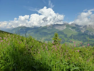
From the Gilbach bus stop, follow the road branching westwards for 600 m. Then head to the wooded ridge and take the very steep, rough path up to the Gilbachegge. The open woodland here offers splendid views of Adelboden and through the Engstlige valley. Soon you reach small ponds where rare dragonflies gather. With decreasing incline, reach the mountain station of the Adelboden-Sillerenbühl cable car. What a view! Along the Niesen chain, you can see to the Lake Thun area. On the opposite valley side rise Elsighorn, Bunderspitz, Chlyne and Gross Lohner, and to the south, Wildstrubel and Wildhorn border the horizon. According to Seybuch, the Alp Sillere provides enough food for 301 livestock units during 10 weeks.
Now descend on the alp road into the saddle and along a wide, gravelly high trail, always staying on the ridge, into the eastern flank of the Lavey ridge. From Vordersillere, the path leads with slight ups and downs over flowery grass slopes and through eroded gullies to the mountain hotel on the Hahnenmoos pass (30 min from Geilsbühl). Magnificent view over the high moor valley to the Wildstrubel-Wildhorn massif!
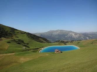
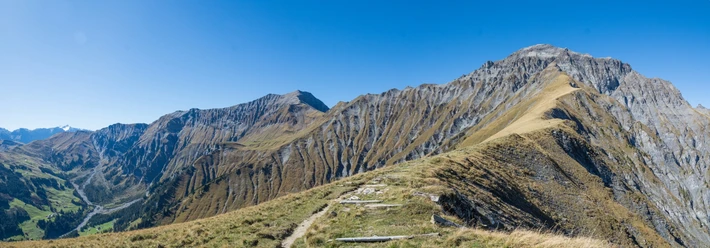
Almost level, continue to the alp ridge leading down from Metschstand and into the flank of the Regenboldhorn to the mountain hut Ufem Blatti (45 min from Geilsbühl). Fields of alpine roses border the way, which reaches the ridge again at Luegli (1 h from Lurnigegga–Geilsbühl). Here you enjoy a great overview of the ski areas around Geilsbühl. The descent into the alp floor of Lurnig is initially quite steep and leads between mighty rocks to Alp Bütschi, where the path changes valley side and goes along the lower edge of the scree slopes under the almost alarmingly wild rising Bütschiflue. Upon meeting the forest road, head west towards the valley floor. With varying incline, the path goes over mountain meadows and through forest quickly down to the intermediate station of the Silleren cable car in Bergläger. A pure pleasure is also the last section of the hike along the rushing Gilsbach to Gilbach.

Good to know
Pavements
Best to visit
Directions
Adelboden/Gilbach - Sillerenbühl - Hahnenmoos pass - Bergläger - Adelboden/Gilbach
Equipment
We recommend the following equipment: sturdy mountain boots, medium-sized backpack with hip belt, sun protection, rainwear, hiking poles, first aid kit, picnic, sufficient fluids, mobile phone.
Additional information
Association Berner Wanderwege, Bern, Tel.: 031 340 01 01, E-Mail: info@beww.ch, Homepage: www.bernerwanderwege.ch
Literature
Hiking suggestion from the hiking book Berner Oberland, hiking book series of the Berner Wanderwege
License (master data)
Safety guidelines
This route runs entirely or partly on marked paths of the mountain hiking trail category
Map
Swisstopo hiking map 1:50,000 263T Wildstrubel
Nearby
Download GPX file