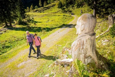
Hike to the Brienzer Rothorn


- 5:00 h
- 9.78 km
- 1,757 m
- 59 m
- 567 m
- 2,266 m
- 1,699 m
- Start: Brienz, train station
- Destination: Rothorn Kulm
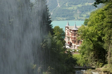
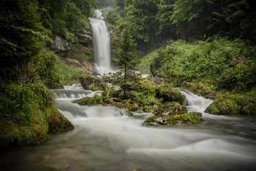
The partly steep sections lead you along the "Milibach" waterfall up to the Planalp, from where you can enjoy a wonderful view of Lake Brienz. It continues over fields and meadows above the tree line to the very top of the ridge of the Brienzer Rothorn.
Current detour:
Since in August 2024 the "Milibach" triggered a major mudslide, the hiking trail along the stream to the waterfall cannot be used until further notice. The detour leads from Brienz along the Trachtbach via the hiking trail towards "Gäldried" to the Planalp.
Are you looking for more hikes?
Find more inspiration about the hiking opportunities in the Bernese Oberland here.

Good to know
Pavements
Best to visit
Directions
Brienz - Gäldried - Planalp - Mittl. Stafel - Ober Stafel - Brienzer Rothorn
Equipment
Directions & Parking facilities
On the A8 motorway to the Brienz exit, then direction Brienz village.
Paid parking spaces at the Brienz Rothorn Railway (parking deck) as well as at the Catholic Church
By Zentralbahn to Brienz, alternatively by BLS boat from Interlaken Ost to Brienz, village.
Additional information
Hauptstrasse 143
3855 Brienz
Tel.: +41 33 952 80 80
info@brienz-tourismus.ch
www.brienz-tourismus.ch
Interlaken Tourism
Marktgasse 1
3800 Interlaken
Phone: +41 33 826 53 00
www.interlaken.swiss/hiking
Brienz Rothorn Railway: www.brb.ch
Mountain lodge Planalp: www.bergrestaurant-planalp.ch
License (master data)

Author´s Tip / Recommendation of the author
Return trip with the Brienzer Rothorn Railway from Rothorn or Planalp possible (June to October).
Mountain restaurants Planalp and Rothorn open from June to October.
Safety guidelines
Nearby


")
