In idyllic Teuffenthal

5.83 km long
Difficulty: easy
Condition: very easy
Hiking Trail
  • 2:20 h
  • 5.83 km
  • 450 m
  • 320 m
  • 985 m
  • 1,394 m
  • 409 m
  • Start: Teuffenthal
  • Destination: Heiligenschwendi

Starting point Teuffenthal Dörfli, STI bus terminal, elevation 988 m above sea level, follow the signposts "Blueme / Heiligenschwendi". After about 1 km on hard surface, we reach Alpberg. Initially through the gently rising terrain to the new stable building, then following the markings with yellow poles to the wooded hollow. On a well-visible path, it goes up the pasture in switchbacks until reaching the forest. In the forest, the ascent is less steep. Soon we reach a forest road. We follow this, always ascending, to a large turning/log storage area, elevation 1312 m. (Variant: Follow the forest road branching right and descend directly to Heiligenschwendi.) Straight ahead, continuing to ascend, it goes to the "Blueme" observation tower. Here, beautiful panoramic views of the Bernese Alps, the Pre-Alps, the Aare valley, the Emmental, and the Jura. Descent on a good path to Heiligenschwendi.

Berner Wanderwege
Berner Wanderwege

Good to know

Pavements

Street
Asphalt
Trail
Path

Best to visit

suitable
Depends on weather

Directions

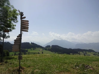
Teuffenthal near Thun – Alpberg – Blueme observation tower – Heiligenschwendi

Equipment

We recommend the following equipment: light trekking shoes, light backpack, sun protection, rain jacket, first aid kit, light picnic, sufficient fluids, mobile phone.

Directions & Parking facilities

Outbound: by train to Thun, with STI bus no. 33 to Teuffenthal near Thun, village, terminal
Return: with STI bus no. 31 and 32 from Heiligenschwendi, Alpenblick to Thun

Additional information

Bernese Hiking Trails, Moserstrasse 27, 3000 Bern 22, Tel. 031 340 01 01, Email: info@beww.ch

License (master data)

Safety guidelines

This route runs exclusively on marked paths of the hiking trail category.

Map

Swisstopo hiking map 254T Interlaken 1:50,000

Nearby