- 6:00 h
- 15.97 km
- 1,000 m
- 1,000 m
- 1,236 m
- 2,057 m
- 821 m
- Start: Lauenen
- Destination: Lauenen
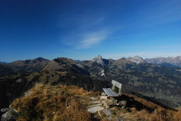
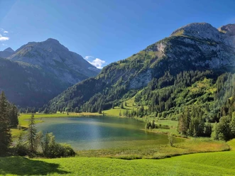
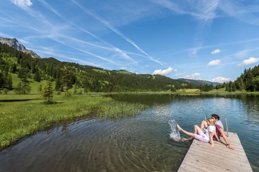
From the village of Lauenen, initially follow the road upstream to the bridge over the Louwibach. Then immediately head along the slope and pass the houses in Fang to ascend to the forest. Through the forest and over alpine meadows, it gently ascends to Höhi and the high terrace Hinderem See. Wonderful views: upstream, Spitzhorn, Wildhorn, Hahnenschritthorn, and Niesehorn border the rocky basin of Gelten; downstream, Wasserngrat and Höhi Wispile frame the Lauenen valley. Soon the charming Louwenesee is reached, situated between alpine meadows and fir forests. At Büel (valley path through the wide marsh area of Rohr to Lauenen 1h), the path enters the deeply incised upper valley section of the Geltenbach. Through a narrow gorge limited by Mutt- and Follhore, one reaches, ascending quite steeply, the alpine floor of Undere Feisseberg. Now the view opens to Geltenschuss. Seeing this series of cascades and whirlpools makes one doubly grateful for the efforts of the Lauenen residents at the time to preserve this primeval landscape untouched. The path climbs along the western valley wall, crossing above the fall the Geltenbach, and continues very steeply up to the Gelten hut of the Swiss Alpine Club (SAC). The valley end called Inneri Gelten is surrounded by a rocky, partly glaciated summit ring. The view downstream is beautiful: southwest into the Furggetäli, south to the Rottal with its waterfalls, and upward to the Gelt Glacier.
The return route follows the east wall of the valley with less gradient to Usseri Gelten. Great caution is necessary on the flank of Follhore, as the rock walls drop steeply to the Geltenbach. Now the path descends to the wide alpine basin Chüetungel (to Tungelschuss–Louwenesee 50 min, mountain hiking trail; to Lauenen, valley path, 1h50). Cross the little bridge over the Tungelbach and head for the west flank of Holzersflue. Steeply now through cliff bands and forest down to Twäregg, then the slope path leads, always 100 to 50 m above the wide marshland of Rohr, via Rysch and Usseri Tüüffi back to Lauenen. Various descent options to the PostBus stops at Louwenesee street are available on the way.

Pavements
- Street (1%)Asphalt (20%)Trail (20%)Path (59%)
Best to visit
- suitableDepends on weather
Directions
Lauenen - Louwensee - Gelten hut SAC - Chüetungel - Lauenen
Equipment
We recommend the following equipment: sturdy mountain boots, a medium-sized backpack with hip belt, sun protection, rainwear, hiking poles, first aid kit, picnic, sufficient fluids, mobile phone.
Additional information
Association Berner Wanderwege, Bern, Tel.: 031 340 01 01, e-mail: info@beww.ch, homepage: www.bernerwanderwege.ch
Literature
Hiking suggestion from the hiking book Berner Oberland, hiking book series of the Berner Wanderwege
License (master data)
Safety guidelines
This route runs entirely or partially on signposted paths of the mountain hiking trail category.
Map
Swisstopo hiking map 1:50,000 263T Wildstrubel