Not for slackers: The Faulhorn in winter


- 4:30 h
- 10.16 km
- 544 m
- 909 m
- 1,796 m
- 2,666 m
- 870 m
- Start: Grindelwald/First
- Destination: Bussalp
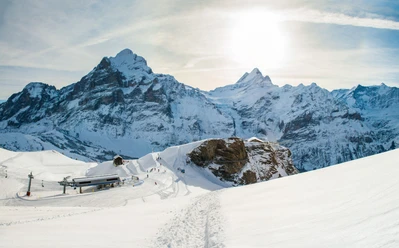
From the First cable car mountain station, the winter hiking trail groomed by piste vehicles stretches generously wide over the slope north of the mountain lodge. After a short but rather steep climb, it soon continues on a level path to Gummihitta and, with slight ups and downs, further to Bachalpsee. Known as a blue jewel in the warm season, it leads a rather inconspicuous existence in winter under a thick layer of ice and snow. However, the untouched landscape, only touched by occasional animal tracks and ski tour lines, exerts a very special charm.
Then follows a long and persistent ascent, though not overly steep, past Burgihitta towards Gassenboden. It is known that the name "Faulhorn" derives from the crumbly rock of which the mountain consists. Nevertheless, it must be noted that this summit is not for lazy people but can only be conquered by diligent climbers.
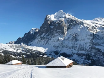
At Gassenboden, the goal, the summit of the Faulhorn with the mountain lodge, comes into view. You should not shy away from this short detour with a few dozen additional meters of ascent, as the view from the summit is magnificent. To the north, the perspective opens up to Lake Brienz and the Augstmatthorn chain; to the east, the peaks of the Schwarzhorn massif and the Wetterhorn soar; to the south, the parade of peaks continues with Schreckhorn, Finsteraarhorn, and Eiger; and to the west, the Lauterbrunnen valley spreads out, rounded off on the horizon by the Blüemlisalp massif. It was an unprecedented pioneering feat when in 1830 the then highest mountain hotel in Europe was built on the Faulhorn. The mountain lodge, which nestles formally into the south slope of the 2680 m high summit, bears witness to the early days of tourism development in the Swiss Alpine region but remains an attractive attraction for day-trippers today. The operation is only open in the summer months.
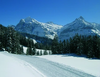
For the return, you initially descend back to Gassenboden on the same route. From there, head eastwards. A sled descent is highly recommended. Under good snow conditions, it is possible to sled all the way down to Grindelwald. This unique route measures no less than 15 km, making it the longest sled run in the world. But even those traveling on foot will not be disappointed during the descent. The track is widely groomed by piste vehicles, providing more than enough space for sledders and hikers. The descent is also not excessively steep. Only at the beginning must a fairly steep gradient be accepted. Afterwards, it continues on a pleasant path down to Oberläger and from there to Bussalp.

Good to know
Pavements
Best to visit
Directions
Equipment
Directions & Parking facilities
Arrival: by train via Interlaken Ost to Grindelwald. On foot or by bus to the valley station First cable car.
Return: by bus from Bussalp to Grindelwald station.
Additional information
Literature
License (master data)
Safety guidelines
Nearby
")