Panorama hike above Lake Thun


- 4:00 h
- 12.66 km
- 510 m
- 640 m
- 559 m
- 1,067 m
- 508 m
- Start: Mülenen
- Destination: Därligen
From Mülenen station, follow the road for about 400 m in the direction of Aeschiried according to the signposting. Now follows the only notable ascent of the entire hike. The path soon levels off again and we hike slightly uphill along a wide grassy ridge above the Suldgraben. A short section at the forest edge leads along a pasture with alpacas. After just over an hour, we arrive in Aeschiried, where we follow the 'Panoramaweg' sign towards Därligen.
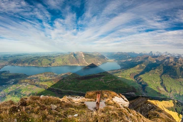
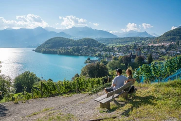
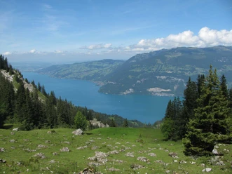
Soon the view of Lake Thun opens up. From Hellbode we hike on an alpine road past the Tipicamp Wildspur to Rossweid. Here we return to a hiking trail. Through forest, then again across alpine meadows, we soon reach the Leissigen panorama suspension bridge. The 60-meter-high and 144-meter-long suspension bridge was built in 2012. After the suspension bridge, the Hotel Meielisalp is soon reached. A rest on its sunny terrace with a magnificent view of Lake Thun is highly tempting (the sunset from here is especially beautiful). From the Meielisalp, one gently descends over the alpine meadows of Stoffelberg to Därligen.

Good to know
Pavements
- Trail (74%)Street (26%)
Best to visit
- suitableDepends on weather
Directions
- Mülenen – Suldhalte - Aeschiried – Hellbode – Chüngstuel - Meielisalp - Därligen
Equipment
- We recommend the following equipment: lightweight trekking shoes, light backpack, sun protection, rain jacket, pocket first aid kit, light picnic, sufficient fluids, mobile phone.
Directions & Parking facilities
- Public transportation
Arrival: by train via Spiez to Mülenen
Return: from Därligen station to Spiez or Interlaken West
Additional information
- Bernese Hiking Trails Association, Bern, Tel.: 031 340 01 01, Email: info@beww.ch, Homepage: www.bernerwanderwege.ch
Literature
Hiking Book Bernese Oberland by Bernese Hiking Trails
License (master data)
Safety guidelines
- This route runs entirely or partly on mountain hiking trails.
Map
Swisstopo Hiking Map 253T Gantrisch & 254T Interlaken 1:50,000