Panoramic hike over the Güggisgrat


- 3:50 h
- 11.48 km
- 360 m
- 1,200 m
- 1,067 m
- 2,063 m
- 996 m
- Start: Niederhorn
- Destination: Habkern
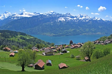
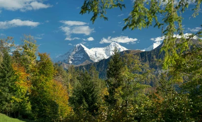
The Niederhorn as the first prominent point of the elongated Güggisgrat has unlimited panoramic views to three sides despite its comparatively low elevation: The Thunersee stretches out deep below, surrounded by a number of villages and impressive forests. Above the jagged pre-Alpine peaks of the Stockhorn and Niesen chains, the Schwalmere and Faulhorn groups, rise the ice giants of the Alps from Wildhorn to Tödi. The view into the Justistal about 800 m below and over the Thunersee into the Frutigland is also overwhelming.
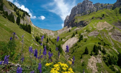
The path first descends over soft alpine meadows to point 1915. Towards Burgfeldstand, the highest peak of the Güggisgrat, the path remains along the ridge edge. Caution is advised on the occasionally quite exposed section to the Gemmenalphorn. Despite rope securing, cliffs dropping off left and right are not to everyone’s liking. The experienced eye spots resting and grazing chamois, and even ibex sometimes rest right in the path. The Gemmenalphorn also invites to a contemplative rest with its extensive panoramic view.
The descent is safe with due caution. In the hollow in front of the huts of Seefeld/Oberberg the paths fork. First heading east, then south, you cross the rear part of the Gemmenalp on indistinct paths gently descending. Limestone humps, fissures, and alpine rose fields determine the landscape. At the Bäreney hut, you turn sharply east. On the northern flank of the Guggihürli, it goes along a level path to the viewpoint Ufem Stand, where you enjoy the view over the Lombach valley to the nearby Harder. The path then descends very steeply over the ridge to Bodmi, from where you reach the Habkern post bus in a few minutes.

Good to know
Pavements
Best to visit
Directions
Equipment
Directions & Parking facilities
To Beatenberg Station Parking spaces can be found at Beatenberg Station for CHF 7.00 per day or in Lood car park for CHF 5.00 per day (12 hours respectively).
If the car park at Beatenberg Station is full, Niederhornbahn AG operates a free shuttle service between Lood car park and the base station for the Niederhorn Mountain Railway.
Getting there: By train to Interlaken. By post bus to Beatenberg/Niederhornbahn. Then continue to the mountain station.
Return: From Habkern by post bus to Interlaken West
Additional information
Literature
License (master data)
Author´s Tip / Recommendation of the author
Safety guidelines
Map
Nearby


")

