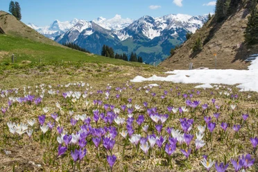
Possibly the most beautiful ascent to the Stockhorn


- 2:45 h
- 6.45 km
- 740 m
- 133 m
- 1,635 m
- 2,182 m
- 547 m
- Start: Chrindi
- Destination: Stockhorn
At the Chrindi middle station, the hiking trail begins at the back of the restaurant towards Vorderstockealp. It immediately passes through small path tunnels above the Hinderstockesee and continues flat to the trail junction P.1639. We turn left and steadily gain height up to the trail junction P.1762. Now it continues to the right at a constant elevation to the alpine huts Vorderstocken at P.1784. We first head towards Oberstockenalp and then descend to Oberstockesee. We walk along its left shore to the trail junction shortly before the Oberstockenalp mountain guesthouse, where the signage shows the way to Strüssligrat. By the way, it is just 100 meters from the junction to the Oberstockenalp mountain guesthouse, which is worth a stop.
At first still comfortable on a flat path, shortly afterward the hands come into use as we overcome the rock step ahead in easy scrambling. After this passage, the path changes direction toward the east and the mountain flank soon narrows to a ridge, the Strüssligrat. We follow this elegant line upwards until suddenly the prominent spur of the Stockhorn comes into view. Right at the base of the rock formation we meet trail junction P.2042. We stay on the sunny side of the mountain and ascend beneath the rocks until just before the mountain station we join the Oberstockenalp hiking trail. From the mountain station it is another 5 minutes to the highest, scenic point of the Stockhorn.

Good to know
Pavements
Best to visit
Directions
Equipment
Directions & Parking facilities
Arrival: on foot from Erlenbach train station to the valley station of the Stockhorn cable car (15 min), then by cable car to the Chrindi middle station
Return: from the Stockhorn cable car mountain station to the valley station, on foot to Erlenbach train station
Additional information
Literature
Hiking book Bernese Oberland by Bernese Hiking Trails
License (master data)
Safety guidelines
Map
Swisstopo hiking map: 253T Gantrisch
Nearby


")
")
")