Rüeggers Trail - Sigriswil (signposted)


- 2:45 h
- 4.69 km
- 260 m
- 260 m
- 1,077 m
- 1,326 m
- 249 m
- Start: Schwanden (Sigriswil) Säge
- Destination: Schwanden (Sigriswil) Säge
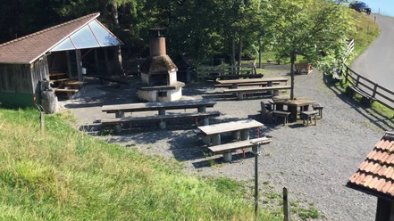
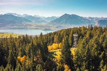
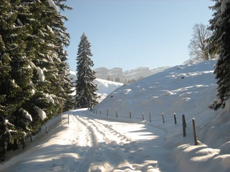
The snowshoe trail starts near the Schwanden-Säge bus stop, above Sigriswil. For the first 150 m, up to the large parking lot, you carry the snowshoes. The trail then follows the summer hiking trail up to the water reservoir. With good snow conditions, small shortcuts are possible on this section. Then it goes moderately steep, alternating through forest or over pastures, past Zenggisboden to the Stampfhütte. Here you have a magnificent view of Lake Thun and the Bernese Alps.
Now the path leads almost flat to the Untere Matte. Here the long Dünzenegg Trail and the shorter Rüeggers Trail separate. The Rüeggers Trail branches off to the left and leads over to the Rüeggershütte. Half of the route is reached here. You should allow yourself a rest at the hut located in a sunny spot.
Then the route continues northwards through the snowy Lischen area of the Rüeggers to its Lischenhütte. Here you meet the long Dünzenegg Trail again. Together it goes along the forest edge and later down in the forest to Zenggisboden. From here you follow the ascent trail back to the starting point at Schwanden-Säge.
With little snow, you start with the snowshoes only at the water reservoir or at Stampf.

Good to know
Pavements
Best to visit
Equipment
Directions & Parking facilities
Additional information
Association Berner Wanderwege, Bern, Tel.: 031 340 01 01, Email: info@beww.ch, Homepage: www.bernerwanderwege.ch
License (master data)
Safety guidelines
This route is signposted as a snowshoe route but not specially prepared.
Map
Nearby


Download GPX file