- 3:50 h
- 10.18 km
- 706 m
- 704 m
- 1,180 m
- 1,840 m
- 660 m
- Start: Wilerallmi ski lift valley station Sigriswil
- Destination: Wilerallmi ski lift valley station Sigriswil
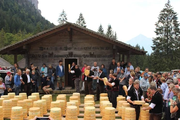
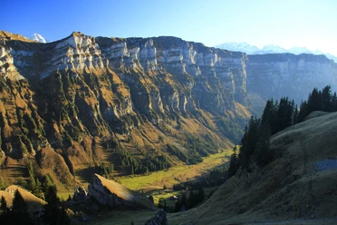
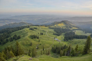
Historical mountain hike (buildings from WWII), starting from Wilerallmi, up the mountain path through the forest to Underbärgli. From the Sennhütte Underbärgli to the forest entrance, you hike along the marked mountain path (red/white) through the Bärglischöpf with views of the Justistal on the lower Rothorn ridge to the entrance of the Schafloch tunnel (enter at your own risk)! Through the historical connecting and logistics tunnel built by the military in WWII (headlamp required) you reach the north side of the ridge. At the exit, a fantastic panoramic view opens over the deep blue Thun Lake to the Bernese Central Plateau and the Jura chain. The descent goes through the protected moor landscape on the mountain path to Zettenalpegg and via the Upper Meadow, Stampf back to Wilerallmi.

Best to visit
- suitableDepends on weather
Directions
Start Wilerallmi – Sennhütte Underbärgli – Forest entrance – Mountain path – Schafloch entrance – through the military tunnel (passing under the Sigriswiler Rothorns at your own risk) – Upper Meadow – Stampf – Endorfallmi – Wilerallmi.
Equipment
We recommend sturdy footwear, a headlamp, and rain protection.
Directions & Parking facilities
- Getting there
By car from Bern via highway A6 to Thun North, continue towards Gunten, turn left to Sigriswil – then continue towards Beatenberg. After the village of Wiler turn left onto the Wilerallmistrasse. Then continue to the Wilerallmi ski lift parking lot (about 30 minutes).
ParkingFree parking at the Wilerallmi ski lift
Public transportationPublic transport from Thun to Sigriswil village with bus line 25. Hike to the start at the Wilerallmi parking lot approx. 1 hour 10 minutes, 3 to 3.6 km.
Additional information
- Sigriswil-Gunten Tourism
Info-Center Gunten
Seestrasse 81
3654 Gunten
Tel. +41 33 251 11 46
gunten@thunersee.ch
www.sigriswil-tourismus.chInterlaken Tourism
Marktgasse 1
3800 Interlaken
Tel.: +41 33 826 53 00
mail@interlaken.swiss
www.interlaken.swiss/wandernDo you want to discover more hikes?
Learn more about the different hiking opportunities in the Bernese Oberland. License (master data)
Author´s Tip / Recommendation of the author
The unique rock formations and the variety of plants and flowers are sustainably inspiring and promote well-being.
There is a charging station for e-bikes at the Wilerallmi parking lot.
Safety guidelines
This route is mostly on marked trails of the Bernese Hiking Paths.
Secure small children on a leash (mountain path Underbärgli-Schafloch) T2-T3.