To James Bond’s Piz Gloria


- 4:40 h
- 9.73 km
- 1,600 m
- 1 m
- 1,638 m
- 2,966 m
- 1,328 m
- Start: Mürren
- Destination: Schilthorn
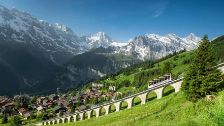
The Mürren station lies above the Mürrenflue, which drops 700–800 m to the valley floor. The place name has evolved from Mons Murren (1257) through Murron, Murn, Mürrn, Murne, Myrrhen to the current designation; it is derived from the Latin murus (= wall) or also associated with Mure (debris or mudflow in the mountains). A viewing platform offers an impressive view across the valley to the Schwarzmönch and the Jungfrau group. From the station (towards Allmendhubel–Schilthorn hut–Schilthorn 4h30), you reach the station of the Schilthorn cable car on the upper main road. Alongside the Mürrenbach rising, a forest path overcomes the first steep stage to Suppenalp (to Allmendhubel 25 min).
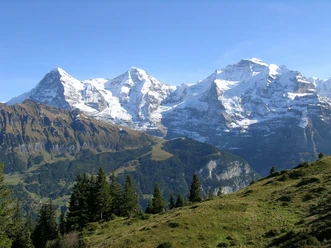
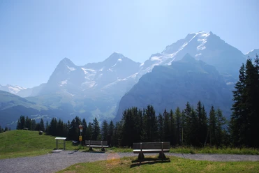
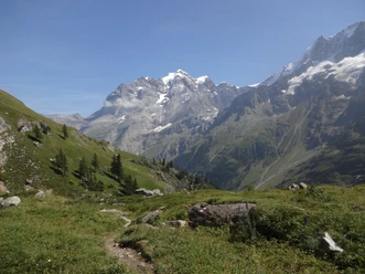
The subsequent high path bypassing the Schilt ridge promises a unique panorama hike. Initially dominated by Männlichen and Jungfrau chains on the horizon, this soon expands to the valley end of the Lauterbrunnen valley with Gletscherhorn, Äbeni Flue, Mittag-, and Grosshorn. The path runs almost level over flower-rich mountain meadows to Alp Im Schilt (to Gimmel–Gimmelwald 1h, –Stechelberg 2h) and to the Schiltbach. Crossing this, it then climbs steeply to the scenic Wasenegg high above the Sefinen valley. (The detour to the nearby viewpoint Bryndli is only recommended for absolutely fearless, sure-footed mountain hikers.) Another magnificent high-level hike allows some rest before the conquest of the last (and longest) steep stage at Tistelwang. The exposed parts on the smooth slate rock are secured with wire ropes. Nevertheless, the very steep climb to Grauseewli is not for everyone. The debris basin of the Seewlifura is rich in high-altitude plants. At point 2620, the path begins to wind up through rocks and debris over the east ridge to the summit of the Schilthorn. This premier viewpoint with its revolving restaurant offers an overwhelming 360° panoramic view and is a well-deserved reward for the effort of the ascent.

Good to know
Pavements
Best to visit
Directions
Mürren - Suppenalp - Wasenegg - Grauseewli - Schilthorn
Equipment
We recommend the following equipment: sturdy mountain boots, medium-sized backpack with hip belt, sun protection, rain gear, trekking poles, first aid kit, picnic, sufficient fluid, mobile phone.
Directions & Parking facilities
Arrival: by train via Interlaken and Lauterbrunnen, then by cable car to Grütschalp and by train to Mürren BLM
Return: by Schilthorn cable car to Stechelberg, Schilthorn cable car, by bus to Lauterbrunnen and via Interlaken back to Bern
Additional information
Bernese Hiking Trails, 031 340 01 01, info@beww.ch, bernerwanderwege.ch
Literature
Hiking suggestion from the hiking book Jungfrau Region Brienzersee - Oberhasli, hiking book series of the Bernese Hiking Trails
License (master data)
Safety guidelines
This route runs entirely or partially on marked paths of the mountain hiking trail category.
Map
Swisstopo hiking map 1:50,000 264T Jungfrau
Nearby

")
")