To roaring waters


- 5:30 h
- 16.04 km
- 900 m
- 870 m
- 1,065 m
- 1,858 m
- 793 m
- Start: Lenk
- Destination: Lenk
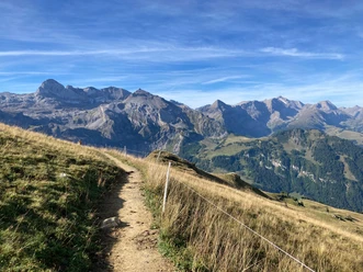
From Lenk station down to the village center and past the Reformed and Catholic churches towards the forest edge. “Uf de Balme” – in the upcoming wooded ridge – are the springs that turned Lenk into a spa, as they count among the most important sulfur springs in the Alps. Along the forest edge to the widely laid out Lenkersee, which was created during World War I by peat extraction and is today a nature reserve. Thousands of years ago, a lake may even have filled the entire valley basin. From the southern end of the lake to the houses of Ey. The carefully laid hiking trail along the flank of the Lengi Egge to Pöschenried offers pure hiking enjoyment. For a while, the Iffigbach roars in the depths, later directly at the path edge. Forest and open land alternate in a pleasant rhythm.
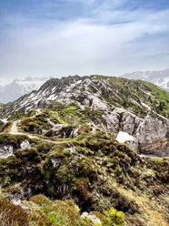
At Langersite, you suddenly stand before the magnificent Iffigfall. With its more than 100 m drop, it is one of the most beautiful waterfalls in the Bernese Oberland. The hiking trail (partly over structures) leads again directly along the primeval stream with its gorge-like sections and waterfalls. At Ritzdole (30 min to Iffigenalp), a forest road branches off to the stream and leads through forest and loose tree cover up to Alp Ritz and the almost flat Langermatte (30 min to Oberlaubhorn, highly recommended!), the scene of the legendary “Wyberschlacht” (see route 15). Now very steeply down over Alp Langer to the most remote alpine huts at Rezliberg. South of the summer inn lie the Sibe Brünne, the springs of the Simme, which discharge up to 3000 liters of water per second in summer. As a wide multi-stream waterfall, the Simme water emerges. In the past, it may have been seven jets that gave the name “Siebental”.
Across the Boden von Stalde you reach the next impressive sight, the Simmenfälle, which were created in the 19th century by diverting the Simme. A narrow footpath leads directly along the bubbling water (caution! A safe variant exists). Finally, enjoy a relaxing riverside walk along the young Simme, with further return options by bus to Lenk in Zälg, Rotebach, and Horlouene.

Good to know
Pavements
Best to visit
Directions
Lenk - Iffigfall - Langermatte - Bi de sibe Brünne - Simmenfäll
Equipment
We recommend the following equipment: sturdy mountain boots, medium-sized backpack with hip belt, sun protection, rainwear, hiking poles, first aid kit, picnic, sufficient liquid, mobile phone.
Additional information
Association Bernese Hiking Trails, Bern, Tel.: 031 340 01 01, E-mail: info@beww.ch, Website: www.bernerwanderwege.ch
Literature
Hiking suggestion from the Simmental - Saanenland hiking book series of the Bernese hiking trails
License (master data)
Safety guidelines
This route runs entirely or partly on mountain hiking trails.
Map
Swisstopo hiking map 1:50,000 263T Wildstrubel
Nearby