- 7:00 h
- 20.04 km
- 1,391 m
- 1,391 m
- 564 m
- 1,937 m
- 1,373 m
- Start: Iseltwald, village square
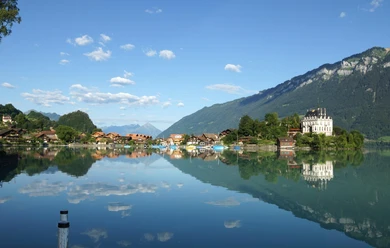
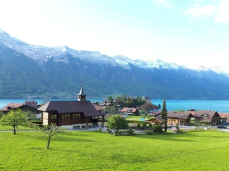
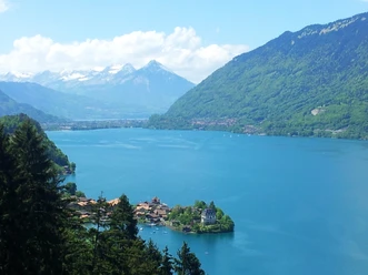
From the village square of Iseltwald, the hiking trail passes by the «Louberli» and continues uphill to «Werzisboden», the first tier of the «Bättenalp» with the restored «Melchhüsi». Here you can enjoy a breathtaking view over the Bödeli, Lake Brienz and Lake Thun up to the Niesen. The hiking trail follows the alpine road, which also goes through a tunnel. Shortly before the tunnel, however, the path turns off again and you reach the «Bättenalp» through karst rock formations. Back on the alpine road, the uppermost tier is then reached.
Part 2
The mountain path continues past the «Schwabhorn», from where you can enjoy a wonderful view of the hidden «Sägistalsee» and finally ends on the Faulhorn at 2681 m above sea level.
Note(s)
The pastures are home to numerous aromatic herbs and grasses. In the mountain spring, a colorful and fragrant bloom unfolds. Also in late summer and autumn, when many plants burst into a second bloom, countless splashes of color appear on the meadows. The high aesthetic and ecological value of this diverse alpine landscape earned the Bättenalp mountain community the Cultural Landscape Award of the Oberland-East region in 2007.
Each year, in the Oberland East region, particularly beautiful and valuable cultural landscapes are awarded the «Cultural Landscape Award». Through support and image promotion by tourism, the award is intended to be a small incentive for farmers to continue sustainable management and thus contributes to the preservation of our beautiful nature.
Are you looking for more hikes?
Find more inspiration about hiking opportunities in the Bernese Oberland here.

Pavements
- Unknown (85%)Street (1%)Asphalt (3%)Path (9%)Trail (1%)Gravel (1%)
Best to visit
- suitableDepends on weather
Directions
- Iseltwald - Werzisboden - Grysigsegg - Bättenalp - Grysigsegg - Werzisboden - Iseltwald
Directions & Parking facilities
- Public transportationFrom Iseltwald by ship or by postal bus.
Additional information
Interlaken Tourism
Marktgasse 1
3800 Interlaken
Tel.: +41 33 826 53 00
mail@interlakentourism.ch
www.interlaken.chLicense (master data)