To the memorial of the Swiss school map


- 2:50 h
- 10.41 km
- 170 m
- 580 m
- 599 m
- 1,007 m
- 408 m
- Start: Heimenschwand, Post
- Destination: Steffisburg, Kirche
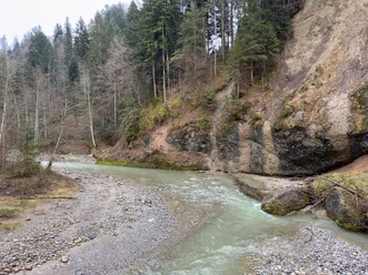
At the starting point, the destination Steffisburg is indicated on the signpost. The path should be easy to find. You leave the village Heimenschwand heading west. Soon you need to turn left. The view falls on the pre-Alps and Alps, such as the Schrattenflue, the Hohgant, Niesen or the Stockhorn. Then comes the first descent via field paths and roads through the hamlet of Birchbühl and near the Ey farms down to the Rotache. Immediately it goes uphill again, first through the forest, then on a field path. At the hill, turn right. Past the signpost location Lood, you reach the Ufem Port farm. The signpost instructs turning left to reach Steffisburg. A short detour straight ahead in the direction of Lueg is worthwhile because shortly after, on the left on a hill, there is a surveying signal. It belongs to the memorial dedicated to Professor Eduard Imhof. The municipality Fahrni thus honors its most famous citizen. The internationally recognized cartographer created countless map works such as the Swiss school map. A rest area invites you to linger and enjoy the view. The panorama ranges from the Alps over the Central Plateau to the Jura. After this detour, the descent to Steffisburg continues. Through the village Rachholtern, you get to Birchi and further down along the Birchigraben and the Schluuchbach to Steffisburg.

Good to know
Pavements
Best to visit
Directions
Equipment
Directions & Parking facilities
Outbound: By train to Thun and then by bus to Heimenschwand, Post
Return: By train from Steffisburg, Kirche to Thun
Additional information
Literature
Hiking book Panoramic hikes of the Bernese hiking trails
License (master data)
Safety guidelines
This route runs exclusively on marked paths of the hiking trail category.
Map
Swisstopo hiking map 1:50,000 253T Gantrisch
Nearby