To the Meteo trail on Gstaad's local mountain


- 2:20 h
- 8.55 km
- 39 m
- 800 m
- 1,170 m
- 1,938 m
- 768 m
- Start: Höji Wispile
- Destination: Gsteig
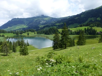
Take the Wispile cable car to the Höji Wispile mountain station. Here is the starting point for the informative Meteo Trail Wispile. The following high path truly deserves its name. Over the pasture, it goes briefly uphill to the highest point of the hike, the Stand: From here, the impressive mountain view extends from the Wildhorn over the mountains of the Sanetsch Pass region to the Oldenhorn, and the panoramic view over the Saanenland is incomparable. You hike southwards over the pasture ridge towards the broad rock pyramid of the Spitzhorn. At the first hut on Höhi Wispile, various descent options are available (to the middle station Underi Bodme 1h; to Feutersoey 1h30, mountain hiking trail; to Lauenen 1h10). At Wispiletritt (to Gschwändvorschess–
Feutersoey 1h, mountain hiking trail) the peaceful strolling on green alpine pasture suddenly ends: the steep forested slope drops down to Chrine (to Lauenen 1h; to Lake Lauenen 1h15). The descent can be easily managed on the excellently laid-out path.
Then you go down through the Ussere Saaligraben valley on a forest road. Further down, the path becomes an asphalt lane. Therefore, you soon switch to a footpath. This path follows the edge of the forest along the Innere Saaligraben and avoids as much as possible the winding small lane that meanders with many loops into the valley floor. Crossing the meadow bottom, you reach Gsteig. Visiting the Hotel Bären, a richly decorated Saanen house from 1756, and the church consecrated in 1453 with wood inlays, the richly decorated pulpit, and the interior walls adorned with Bible verses is highly recommended.

Good to know
Pavements
Best to visit
Directions
Equipment
Directions & Parking facilities
Outbound journey: by train to Gstaad. Then on foot or by bus to the valley station of the Wispile cable car.
Return journey: by bus from Gsteig to Gstaad train station
Additional information
Literature
License (master data)
Safety guidelines
Map
Nearby

