To the source of the Saane


- 4:10 h
- 9.96 km
- 1,010 m
- 1 m
- 1,178 m
- 2,061 m
- 883 m
- Start: Gsteig
- Destination: Barrage du Sanetsch
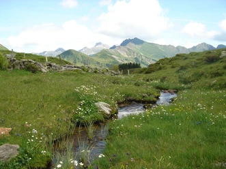
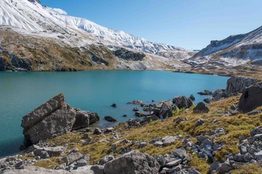
From the bus stop in Gsteig, follow the signs towards Sanetschbahn (where you can also park). Along the rushing Saane, the mountain hiking trail ascends to Rotegrabe. A few years ago, a large rockfall from the west flank of the Spitzhorn destroyed the historic mule track here. The avalanche area is no longer accessible today, which is why the hiking trail had to be relocated. Across a new bridge we cross the Rotegrabe and reach the newly laid path, which a little further up reconnects with the original hiking trail. Here we leave the forest and climb numerous switchbacks, with the view towards Gsteig gradually opening up. The last rock step leads to the left, and soon the Sanetschsee is reached.
At the Barrage du Sanetsch junction, you can turn right directly to the Sanetsch cable car station. However, the one-hour round walk around the Sanetschsee without any significant additional elevation gain is still very appealing. Keeping left, follow the eastern shore to the bridge on the other side of the lake (P.2040), which crosses the still small stream of the La Sarine. On the western side, the trail returns, winding through some large boulders that at some time fell down from the cliffs of the Mountons. Over the dam wall at the northern end, you reach the Auberge du Sanetsch. The sun terrace invites you to linger before the cable car takes us back to Gsteig.

Good to know
Pavements
- Street (22%)Trail (17%)Path (61%)
Best to visit
- suitableDepends on weather
Directions
- Gsteig – Sanetschbahn – Rotegrabe – Barrage du Sanetsch - Circular route around the Sanetschsee
Equipment
- We recommend the following equipment: sturdy mountain boots, medium-sized backpack with waist belt, sun protection, rainwear, hiking poles, pocket first aid kit, picnic, enough fluids, mobile phone.
Directions & Parking facilities
- Getting thereBy car via Zweisimmen to Gstaad and on to Gsteig. At the church keep left and follow the signs to Sanetschbahn up to the parking lot at the Sanetsch power plant.Public transportationRound trip: by bus from Gstaad station to Gsteig Post stop
Additional information
- Bernese Hiking Association, Bern, Tel.: 031 340 01 01, E-mail: info@beww.ch, Homepage: www.bernerwanderwege.ch
Literature
Bernese Oberland hiking book by the Bernese Hiking Association
License (master data)
Safety guidelines
- This route runs entirely or partly on mountain hiking trails.
Map
Swisstopo hiking map: 263T Wildstrubel 1:50,000