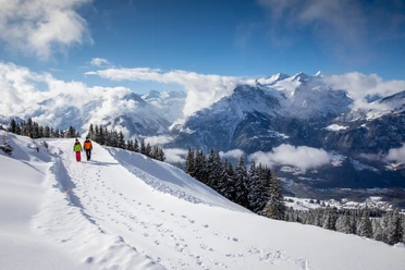
Under the spell of the Wendenstöcke in the Gadmen valley


- 3:00 h
- 7.08 km
- 100 m
- 380 m
- 925 m
- 1,210 m
- 285 m
- Start: Gadmen/Obermad
- Destination: Nessental/Dorf
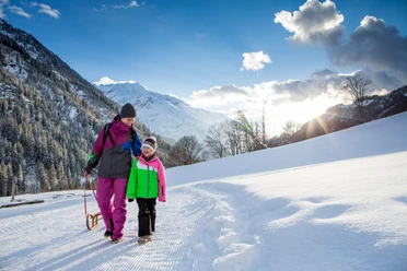
At the beginning of winter, the valley floor remains in the shade until noon. When snow has fallen, it often stays for a long time in the Gadmen valley, and the variety of winter activities pays off. Hiking through a quiet, untouched winter landscape is particularly rewarding.
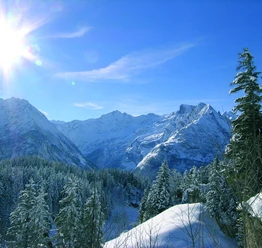
The Gadmer Dolomites, as the Wendenstöcke are also called, are already bathed in sunlight early in the morning and shine warmly over the still dark valley floor. From the Gadmen / Obermad bus stop, walk a few meters back towards Gadmen before the winter hiking trail branches off to the right and leads over pastures and meadows to Gadmen. Rosa Tänndler, who modeled for the portrait on the Goldvreneli in the 19th century, came from this small mountain village. This most famous Swiss gold coin was minted over 58 million times until 1949 and is passed down in many families from generation to generation today.
Gadmen is better known for the annual sled dog race that attracts crowds of spectators.
From Gadmen, continue to Fuhren. Occasionally, there are rumblings in the limestone walls as snow and stones loosen somewhere. In winter conditions, it is hard to imagine that the impressive rock walls are a climbing paradise in summer and delight climbers from all over the world with over 100 multi-pitch routes. In Fuhren, just a few steps from the winter hiking trail and the bus stop, there is a restaurant where you can warm up.
The winter hiking trail now leads along narrow, scarcely trafficked roads past the hamlet of Schaftelen and the valley station of the Trift cable car. It continues to the hamlet of Twirgi and then downhill to Nessental. Here too, there is an opportunity to spend waiting time for the bus comfortably with coffee and cake in warmth.
Text: Sabine Joss

Good to know
Pavements
Best to visit
Directions
Equipment
Directions & Parking facilities
Return: by post bus from Nessental/Dorf
Additional information
Literature
License (master data)
Safety guidelines
Increased avalanche danger in spring and with sudden weather changes. Helpful, but not mandatory, are an avalanche transceiver (LVS device), a probe and a shovel. Inform yourself about snow conditions and possible avalanche dangers before the tour.
Behavior
Do not take unnecessary risks and respect your limits. Always stay on marked routes. Avoid wildlife if possible, behave quietly. Observe animals from a distance. Pack your waste again and leave no unwanted traces.
Map
Nearby