Up and down cheerfully in the Kiental


- 3:00 h
- 8.75 km
- 540 m
- 530 m
- 1,201 m
- 1,511 m
- 310 m
- Start: Kiental, Ramslauenen mountain station
- Destination: Kiental, Griesalp
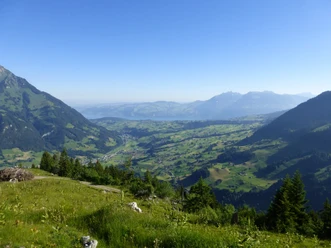
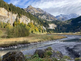
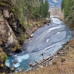
Politically, the Kiental belongs to the municipality of Reichenbach im Kandertal. The Kiental is off the main tourist streams. It is therefore an area where you can slow down and relax. The leisurely ride on the chairlift also contributes to this. At the start of the route, Griesalp is listed on the signpost as the destination. Therefore, the route is easy to find. Parts of the path were rebuilt in 2015. First, the trail goes downhill on a road. After a bend, turn sharply right onto a path. This path is additionally signposted as the Guggerweg. Several boards provide explanations about native animal species such as the cuckoo. After the first forest section, the view down the valley is rewarding. After the second forest section, you reach a road and leave the Guggerweg. Now the trail initially ascends, then continues flat to Brüggbärgli. Looking up the valley, you can see the Blüemlisalp range, the Tschingelsee lake, and the Dündenfall waterfall. A path or trail through pastures and forest passes by Gure. On the steep ascent that follows, it is worth looking back to spot Lake Thun and the Niesen mountain. The Dündenfall announces itself with its roaring. The mighty waterfall is impressive; a footbridge passes closely by it. Once you reach the hike’s goal, the Griesalp bus stop, the last experience awaits: the ride on Europe’s steepest post bus route.

Good to know
Pavements
Best to visit
Directions
Ramslauenen – Brüggbärgli – Gure – Mittelberg - Griesalp
Equipment
We recommend the following equipment: sturdy hiking boots, medium-sized backpack with hip belt, sun protection, rain gear, hiking poles, first aid kit, picnic, sufficient liquids, mobile phone.
Directions & Parking facilities
Outbound: By train to Reichenbach im Kandertal, then by bus to Kiental and further by chairlift to Ramslauenen
Return: By bus from Griesalp to Reichenbach im Kandertal and further by train
Additional information
Association Bernese Hiking Paths, Bern, Tel.: 031 340 01 01, E-mail: info@beww.ch, Homepage: www.bernerwanderwege.ch
Chairlift Ramslauenen: kiental-sesselbahn.ch
Literature
Hiking book short hikes 2 of the Bernese hiking paths
License (master data)
Safety guidelines
This route runs entirely or partially on marked trails of the mountain hiking path category.
Map
Swisstopo hiking map 264T Jungfrau 1:50,000
Nearby