- 3:10 h
- 11.24 km
- 170 m
- 560 m
- 558 m
- 1,025 m
- 467 m
- Start: Aeschiried / School
- Destination: Spiez / Train station
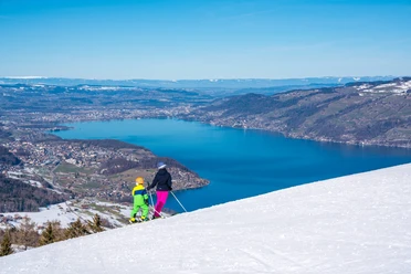
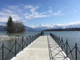
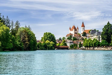
From the Aeschiried bus stop, follow the route first in the direction of the signposted panoramic trail with the best view of Lake Thun. At Hellbode, turn left and walk on the road for about 10 minutes until the yellow-marked trail to Krattigen branches off diagonally to the right. On the opposite shore of Lake Thun, the Niederhorn is impressively visible. Upon arrival in Krattigen, cross the main road and turn diagonally right into Schulhausgasse. Via Schüpfgasse it goes to Chrattigbach. Cross it and follow the hiking trail down to the shore of Lake Thun and the small harbor of Faulensee, the Güetital. Several fire pits and a bathing beach invite you to rest here. Now follow the promenade along the beach to Faulensee and continue along the beautiful lakeside path to the Spiezer Bay, the «most beautiful bay in Europe» according to advertising brochures. On the other side of the bay, follow the hiking trail to Spiez Castle, whose castle church is one of the twelve thousand-year-old churches on Lake Thun. Following Schlossstrasse, then turn right into Rebbergweg. After a small ascent, you reach the Spiezberg nature reserve. Stroll along the forest edge with a wonderful view over the Spiezer Bay to the Bernese Alps. The path then goes through a stretch of forest before you start the descent via Sonnenfelsstrasse. The yellow markings lead down to the roundabout in the town centre. Opposite, turn into Seestrasse and after 100 meters to the right to the Spiez train station.
Background: Hard to believe, but vines have been cultivated on Lake Thun for over 1000 years. Thanks to Lake Thun, which acts as a heat reservoir, and the frequent föhn winds, Riesling Sylvaner and Pinot Noir thrive here at 600 m above sea level. In the middle of the Spiezer vineyards lies Spiez Castle, which is considered a cultural asset of national significance.

Pavements
- Asphalt (19%)Gravel (28%)Trail (11%)Path (27%)Street (16%)
Best to visit
- suitableDepends on weather
Directions
- Aeschiried – Krattigen – Güetital – Faulensee – Spiez / Städtli – Spiez
Equipment
We recommend the following equipment: light trekking shoes, light backpack, sun protection, rain jacket, first aid kit, light picnic, sufficient fluids, mobile phone.
Directions & Parking facilities
- Public transportationOutbound: by bus to Aeschiried / school
Return: by train from Spiez
Additional information
- Berner Wanderwege, 031 340 01 01, info@beww.ch, bernerwanderwege.ch
Literature
License (master data)
Author´s Tip / Recommendation of the author
- Time can be well spent in and around Spiez Castle – either in the museum, in the art exhibition, the church, the park or the café (schloss-spiez.ch). If you want to shorten the hike, you can start either in Krattigen (2 h 15 min) or in Faulensee (1 h 30 min).
Safety guidelines
- This route runs exclusively on signposted paths of the category hiking trail.
Map
- swisstopo hiking maps: 253T Gantrisch, 254T Interlaken