Foaming white water in the Kiental


- 2:10 h
- 7.77 km
- 36 m
- 550 m
- 922 m
- 1,410 m
- 488 m
- Start: Griesalp
- Destination: Kiental, village
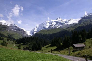
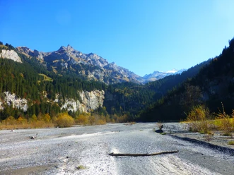
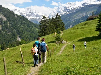
The approximately 1 km long mountain road from the Tschingelsee to the Griesalp has no less than 20 partly very narrow and steep curves. The gradient is up to 28 percent. For this reason, the road is considered the steepest post bus route in Europe. From the Griesalp terminal station, you descend into the valley to the Pochtenalp and onto the wild water trail. The hiking trail runs more or less parallel to the Gornerewasser, which plunges down in several steep stages here – including the impressive Pochtenfall. In between, the stream forms wildly foaming whirlpools. Sometimes the path runs very close to the water, then again it maintains a duly respectful distance. In the valley floor, you reach the Tschingelsee. This lake was only formed in 1972 after a heavy thunderstorm; at that time, the valley floor was sealed off 6 m high with debris and mud. The lake has been under nature protection since 1987 and is now gradually silting up. At Alpenruhe, the path switches to the west side of the stream. On the valley path, you gently descend over Losplatte to the valley station of the Ramslauenen chairlift and from there, after a short climb, reach the small village of Kiental. In the local Hotel Bären in 1916, a conference of the International Socialists was held disguised as a tourist event, attended among others by Lenin.

Good to know
Pavements
Best to visit
Directions
Griesalp - Tschingelsee - Alpenruhe - Kiental
Equipment
We recommend the following equipment: lightweight trekking shoes, light backpack, sun protection, rain jacket, pocket first-aid kit, light picnic, sufficient fluids, mobile phone.
Directions & Parking facilities
Outbound journey: By train to Reichenbach in Kandertal. Change to the post bus to «Griesalp, Kurhaus» (final stop)
Return journey: By post bus from «Kiental, village» back to Reichenbach station.
Additional information
Bernese Hiking Trails, T 031 340 01 01, info@beww.ch,
Literature
Hiking suggestion from the short hikes guidebook, guidebook series of the Bernese Hiking Trails
License (master data)
Safety guidelines
This route runs entirely on hiking trails.
Map
Swisstopo hiking map 1:50,000 264T Jungfrau
Nearby