From the alpine town to the foot of the Stockhorn


- 2:35 h
- 9.80 km
- 170 m
- 74 m
- 559 m
- 729 m
- 170 m
- Start: Thun, Lerchenfeld
- Destination: Blumenstein
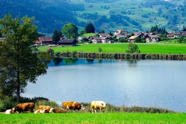
The lake gives Thun a generous spaciousness that sometimes masks the fact that the town lies near considerably high mountains. A hike from the gates of the town to the foot of the Stockhorn gives an impression of this "mountainous" side of Thun. On the way, the impressive silhouette of the Stockhorn-Gantrisch chain is displayed in all its glory. The starting point is the Waldeck bus stop. First, follow 200 m of the cantonal road towards Uetendorf/Thierachern. After crossing the motorway, keep right and turn left outside the forest onto the little road that passes through the Thierachern district Brügg.
Soon the area takes on a distinctly rural character: wide grassy areas, some fields, dense woods, and extensive hedges shape the landscape. Passing the farm Nussbaummatt, you reach the Rosindlirain and from there, with a gentle ascent, the hamlet Willerüti. Here the route turns at a right angle to the south. The view of the Aare valley, the jagged ridge of the Sigriswiler Rothorn, and the ice-crowned Bernese High Alps is enchanting. Then follows a small, idyllic woodland where the hiking trails branch off. Here, keep straight ahead, soon returning to open terrain and reaching the Thierachern district of Wahlen past several isolated farms.
On paved little roads, gravel paths, and narrow forest trails, continue to the crossroads Bächi. The signpost already shows the destination Blumenstein. Before that, you pass through the village of Uebeschi and ascend, on a scenic but unfortunately entirely paved route, over the ridge of Honegg between Glütschbachtal and Stockental. The distinctive rocky peak of the Stockhorn has meanwhile gotten ever closer. Passing the old mill, you reach the bus stop in the center of the elongated village Blumenstein.

Good to know
Pavements
Best to visit
Directions
Equipment
Directions & Parking facilities
Outbound journey: By STI bus no. 50 or 51 from Thun train station to Lerchenfeld, stop Brügg
Return journey: From Blumenstein by STI bus to Thun (various lines possible)
Additional information
Literature
Hiking suggestion from the hiking book Thunersee - Frutigland, hiking book series of the BWW
License (master data)
Safety guidelines
Map
Swisstopo hiking map 1:50,000 253T Gantrisch
Nearby


