From the Diemtigtal to the Seebergsee


- 6:40 h
- 18.10 km
- 1,050 m
- 1,050 m
- 1,081 m
- 1,929 m
- 848 m
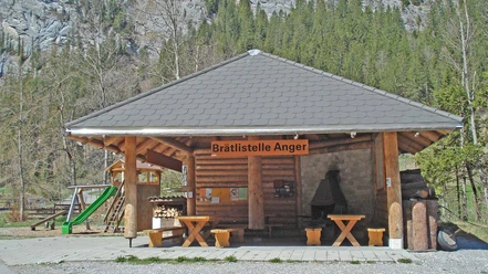
- Start: Zwischenflüh, Anger
- Destination: Zwischenflüh, Anger
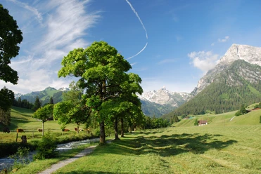
From the post bus stop Zwischenflüh/Anger following the Fildrich and the lower forest edge downstream. The little road soon turns into a footpath which leads into the Meniggrund road at the Narenbach. Almost imperceptibly, you ascend along this road through the Meniggrund (to Hinter Menigen–Seebergsee 2h15; mostly paved). The valley offers a charming view: lush meadows, groups of sycamore maples, and flower-decorated houses in the valley floor, above that coniferous forests and bright rock towers and walls.
At point 1259, you initially ascend on a small road quite steeply towards the southeast. After the curve, the path lays along the forest edge and finally leads over open pasture to the alpine hut and the cluster of houses Menigwald. A wonderful rest stop is at the ridge saddle at point 1851 (to Meniggrat 30 min, caution: steeply falling rocks! Magnificent deep view into the Diemtigtal). On the broad panoramic balcony of Stand, looking back between the peaks of the Niesen range, some high alpine peaks from Schreckhorn to the Adelboden Grossstrubel can be seen, ahead lie Vanil Noir, Dent de Ruth, and the rugged saddle peaks. Over the ridge crest down to Alp Seeberg and through the alpine hollow into the quiet Seebergsee. Spruce groups enliven the alpine pastures on the left side of the lake. The opposite slope rises steeply to the Muntiggalm and the Geisshörnli. Swiss stone pines have grown on large rockslide debris blocks. Decades ago, this gem was seriously endangered as hydropower use was considered. Fortunately, the project proved uneconomical.
For the return, choose the route again via Seeberg–Stand to point 1851. Here it goes very steeply downwards to the right towards the forest edge and through many zigzags on an ideal mountain path through the forest down to the Muggenbach. Follow this to the post bus stop Schwenden, where, as a kind of enjoyable dessert to a wonderful hike, the valley path following the Fildrich offers a return to Zwischenflüh/Anger. Along the way, there is the possibility to admire the magnificently painted facade of the inn in Tiermatti (5 min from the valley path).

Good to know
Pavements
Best to visit
Directions
Zwischenflüh, Anger - Meniggrund - Seebergsee - Schwenden - Zwischenflüh, Anger
Equipment
We recommend the following equipment: sturdy mountain boots, medium-sized backpack with hip belt, sun protection, rainwear, hiking poles, pocket first aid kit, picnic, sufficient liquids, mobile phone.
Directions & Parking facilities
Outbound and return travel: by train to Oey-Diemtigen. From there by bus to the stop Zwischenflüh, Anger
Additional information
Association Bernese Hiking Trails, Bern, Tel.: 031 340 01 01, E-mail: info@beww.ch, homepage: www.bernerwanderwege.ch
Literature
Hiking suggestion from the hiking book Bernese Oberland, hiking book series of the Bernese hiking trails
License (master data)
Safety guidelines
This route runs fully or partially on marked trails of the mountain hiking path category.
Map
Swisstopo hiking map 1:50,000 263T Wildstrubel
Nearby


Download GPX file