- 4:30 h
- 12.80 km
- 400 m
- 1,400 m
- 660 m
- 1,811 m
- 1,151 m
- Start: Chrindi
- Destination: Blumenstein
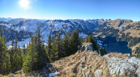
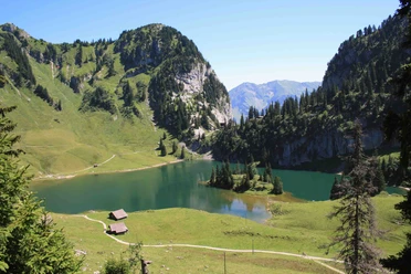
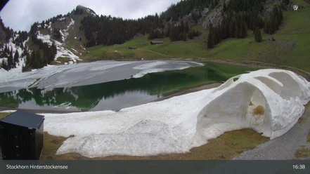
From the Chrindi middle station of the Stockhorn cable car, first descend to Hinterstockensee, then gently ascend to Oberstocken and continue to Oberstockensee. From there the path leads with slight ups and downs over the Bättelwägli to Walalp. Here you are offered a beautiful panoramic view of the Gantrisch area. After a short ascent you reach the Walalp ridge. The viewer has the Aare valley from Thun to Bern at their feet. Almost like an aerial photo, the upper Gürbetal is presented.
The descent to Blumenstein takes place on the historically renovated alpine path in the Chrümmelwägen area, completed a few years ago. The path overcomes the considerable altitude difference in wide hairpin bends and is designed to be nowhere excessively steep. Beautiful dry stone walls support the slope and keep the path free from debris. Thus, the descent becomes a pure pleasure, which is additionally enhanced by ever-new low views of the lake landscape of the Thuner Westamt formed by ice age glaciers.
The church in Blumenstein, built around 1285, is worth a stop. Particularly worth seeing are the well-preserved stained-glass windows dating from the golden age of Königsfelden stained glass art. From the church, it is about a 20-minute walk to the village center and the bus stop.

Pavements
- Path (60%)Trail (32%)Asphalt (8%)
Best to visit
- suitableDepends on weather
Directions
- Chrindi - Walalp - Chrümmelwägen - Blumenstein
Equipment
- We recommend the following equipment: sturdy mountain boots, medium-sized backpack with hip belt, sun protection, rainwear, hiking poles, pocket first aid kit, picnic, sufficient fluids, mobile phone.
Directions & Parking facilities
- Public transportation
Arrival: Take the Stockhorn cable car from Erlenbach to the Chrindi middle station
Return: By bus from Blumenstein to Thun
Additional information
- Association of Bernese Hiking Trails, Bern, Tel.: 031 340 01 01, E-Mail: info@beww.ch, Homepage: www.bernerwanderwege.ch
License (master data)
Safety guidelines
- This route runs entirely or partially on mountain hiking trails.
Map
- Swisstopo hiking map 1:50,000 253T Gantrisch