Hike along lakes between Gürbe and Simme


- 4:45 h
- 18.51 km
- 160 m
- 127 m
- 594 m
- 686 m
- 92 m
- Start: Wattenwil
- Destination: Wimmis
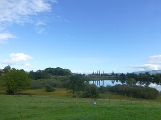
From the center of Wattenwil to the bank of the Gürbe and follow it upstream on the nature trail. Over the covered bridge across the Gürbe to the group of houses Längmoos. On the ascent to Allmid magnificent view of the Stockhorn and the entire Stockhorn-Gantrisch range. Keeping the direction to the partly hidden Geistsee behind bushes and reeds (no access, private property). Now heading southwards away from the road to the Längenbüelwald and crossing it to the group of houses Bim Wald. A gentle ridge is crossed by a track from which the picturesque Dittligsee can be best seen. Through a moraine hollow a small road runs from Hattigen to Kärselen. The path conditions are not always easy here, as the farms and villages between Gürbe and Glütschbach are connected by an exceptionally dense network of roads.
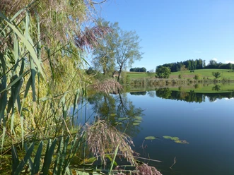
The two small woods ahead are bypassed on the left by walking through a gentle hollow, the former Subelmoos, to Weiersbüel and thus bypassing the village of Uebeschi. The small road now runs along the Übeschi and Amsoldingersee to Amsoldingen. Both small lakes lie in swampy hollows covered with reeds. The former provost church St. Mauritius in Amsoldingen rises impressively. The adjacent castle – the former provost building – has been privately owned since 1496. Now turning towards the center of town and heading into the forest to the houses of Galgacher on the steep slope to the Glütschbach. More or less following the edge of the ridge it goes over meadowland and through forest to Zwieselberg. Suddenly, the whole splendor of the Bernese Alps lies ahead. Through the strip of forest on the lower left flows the Glütschbach downstream towards the Aare in the former Kander riverbed. From Farb it goes off the main road to Reutigen/Allmi, then along the Kander and later the Simme. Over the wooden Simmesteg bridge you change the riverbank and reach Wimmis.

Good to know
Pavements
Best to visit
Directions
Wattenwil - Geistsee - Amsoldingen - Zwieselberg - Wimmis
Equipment
We recommend the following equipment: Light trekking shoes, light backpack, sun protection, rain jacket, first aid kit, light picnic, sufficient fluids, mobile phone.
Additional information
Association Bernese Hiking Trails, Bern, Tel.: 031 340 01 01, email: info@beww.ch, homepage: www.bernerwanderwege.ch
Literature
Hiking suggestion from the hiking book Thunersee - Frutigland, hiking book series of the Bernese hiking trails
License (master data)
Safety guidelines
This route runs entirely on hiking trails.
Map
Swisstopo hiking map 1:50,000 253T Gantrisch
Nearby