The waterfalls of the Gürbe


- 4:00 h
- 15.19 km
- 100 m
- 1,120 m
- 567 m
- 1,590 m
- 1,023 m
- Start: Gurnigel / Wasserscheide
- Destination: Burgistein
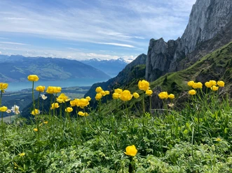
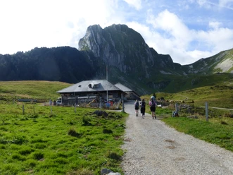
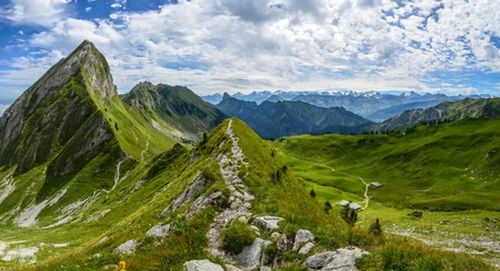
Already at the Wasserscheide stop, a magnificent mountain panorama with views of the impressive Gantrisch range and the Bernese Alps offers itself. At the beginning of the hike, follow the Gurnigel pass road briefly south-east and then keep left on the still yellow marked hiking trail towards Oberwirtneren / Blumenstein. Along the way, you pass the small but impressive Gürbe waterfall on the right. At the next fork, turn left uphill toward Schwändli / Wattenwil. Passing the Tschingelhütte, you reach Schwändli. Now marked white-red-white, the hiking trail leads down into the Riselbruch, where you meet the Gürbe. Now follow the narrow path, which initially rises with a few switchbacks while the Gürbe falls over concrete barriers to the right. The riverside path now runs along numerous of these concrete steps – in some places, you could also easily make a detour down to the water of the Gürbe here. After Weiermoos, the path becomes wider and is marked for the rest of the route as a yellow hiking trail. Always keeping the Gürbe on the right and the riparian forest on the left, you soon reach the Bluemisteibrügg. The path now passes the large debris fan and you reach the covered Längmoos bridge. Continuing along the Gürbe whitewater path and nature trail, you walk to Wattenwil. Here, you change the riverside. Two Gürbe crossings later, follow the signs to Burgistein station, the end point of the hike.

Good to know
Pavements
- Trail (47%)Street (4%)Gravel (8%)Path (39%)Asphalt (2%)
Best to visit
- suitableDepends on weather
Directions
- Wasserscheidi – Weiermoos – Längmoos – Wattenwil – Burgistein Station
Equipment
We recommend the following equipment: sturdy hiking boots, medium-sized backpack with hip belt, sun protection, rainwear, trekking poles, first aid kit, picnic, sufficient fluids, mobile phone.
Directions & Parking facilities
- Public transportationOutbound: by train to Thurnen or Schwarzenburg, then by bus to Gurnigel / Wasserscheide
Return: by train from Burgistein
Additional information
- Bernese Hiking Trails, 031 340 01 01, info@beww.ch, bernerwanderwege.ch
Literature
License (master data)
Author´s Tip / Recommendation of the author
- Those who want can go at the point where the Gürbe flows away from the shore between Bluemisteibrügg and Wattenwil over the wide debris fan and thus reach the modern sediment collector (driven steel pipes). Those who want to shorten the hike can either go only as far as Wattenwil (about 30 minutes shorter) or to Bluemisteibrügg and then hike to Blumenstein (one hour shorter).
Safety guidelines
- This route runs entirely or partly on marked trails of the mountain hiking trail category.
Map
- swisstopo hiking map: 253T Gantrisch