Lieselotteweg at Männlichen - Grindelwald


- 2:30 h
- 3.54 km
- 650 m
- 1,628 m
- 2,222 m
- 594 m
- Start: Top station Männlichen
- Destination: Middle station Holenstein
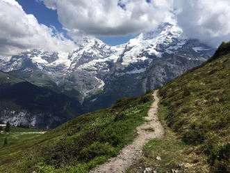
Lieselotte is the famous cow from a small village in Germany. Now she is finally on vacation, here with us in the Bernese Oberland. You are invited to accompany Lieselotte and her friends, the chickens, on their very first hike in the Alps. After an extensive gondola ride from Grindelwald Terminal to Männlichen, the hike proceeds step by step, happily following the tracks of the Grindelwald cows down toward the valley.
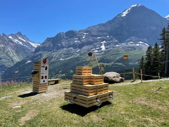
Along the way, 13 attractive experience stations with fun play opportunities await you. Excitement is guaranteed: you can search for the mountain crystal together with the chickens, try alphorn blowing, or climb the Eiger north face like real mountaineers. With so much play, fun, and enjoyment, hiking happens almost effortlessly and naturally, always with the majestic Eiger in view. The wonderful experience hike ends at the Holenstein middle station, where a new gigantic treetop walk awaits you. The cable car then conveniently takes you back to Grindelwald.

Good to know
Pavements
- Trail (97%)Asphalt (3%)
Best to visit
- suitableDepends on weather
Directions
Männlichen - Holenstein via signposted hiking trail.
Directions & Parking facilities
- Getting thereVia Interlaken - Wilderswil to Grindelwald.Parking
Parking at Grindelwald Terminal (parking garage)
Public transportationOutbound and return travel: From Interlaken Ost with the Bernese Oberland Railway to Grindelwald Terminal, from there it is only a few steps to the valley station of the Männlichen cable car, which is also located in the terminal.
Additional information
Cable car Grindelwald - Männlichen, 033 828 75 55 or at mail@maennlichen.ch,https://www.maennlichen.ch/de/sommer/erleben/lieselotteweg.html
Literature
- Free brochure ''Hiking with children'' - available from Bernese hiking trails (info@beww.ch)
License (master data)
Author´s Tip / Recommendation of the author
Suitable for children from 3 years old. Not suitable for strollers. Restaurant at the starting point of the hike as well as two picnic areas with fire pits (wood is available on site) along the hiking route.
Safety guidelines
The described hike runs exclusively on marked paths of the category hiking trail.
Map
- Swisstopo hiking map 1:50,000 254T Interlaken