- 3:15 h
- 7.99 km
- 780 m
- 60 m
- 1,232 m
- 1,962 m
- 730 m
- Start: Adelboden / Oey
- Destination: Engstligenalp
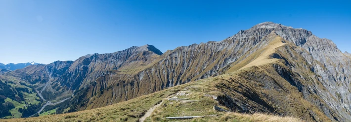
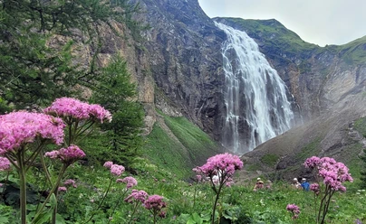
Various paths lead to the Engstligenalp. However, if you want to hike by the water, you should start in Oey near the village of Adelboden. Here you follow the signposts "Luftseilbahn Adelboden" and later "Unter dem Birg". After a few steps, you cross the Allebach and shortly afterwards the route turns right onto a path that follows the Entschlige upstream. On the right, you can see the Chuenisbärgli, where the ski circus stops every year. After the Raufmattebrügg, the Entschligefäll are in sight. One kilometre later the path forks – now you go right and continue following the water via Chäli. The Entschlige is crossed again and the path begins to climb. The cable car route is crossed twice in a loop, and shortly afterwards there is a fork. If you now choose the right path, it leads to the Entschligefäll within a short time. The detour is rewarded with a unique natural spectacle. The water rushes impressively into the valley. On a bridge, the stream can be crossed safely. You can feel the spray of the roaring waterfall. Having admired it enough, the ascent continues and the stream is crossed again. Eastwards, you pass the first guesthouses to the mountain station of the cable car.
Background: The waterfalls plunging about 600 metres deep into the valley from the Engstligenalp are considered a spectacular natural attraction. As the second highest waterfalls in Switzerland, they have been under cantonal nature protection since 1948. With its extensive mountain meadows, impressive mountain panorama and long alpine tradition, the Engstligenalp was included in the Federal Inventory of Landscapes and Natural Monuments of National Importance in 1996. The high plateau at 2000 m above sea level at the foot of the Wildstrubel also serves as a starting point for numerous hiking and mountain tours.

Pavements
- Street (4%)Gravel (1%)Asphalt (17%)Path (61%)Trail (17%)
Best to visit
- suitableDepends on weather
Directions
- Adelboden / Oey – Bir Müli – Raufmattebrügg – Entschligefäll – Engstligenalp
Equipment
We recommend the following equipment: sturdy mountain boots, medium-sized backpack with hip belt, sun protection, rainwear, hiking poles, first aid kit, picnic, sufficient fluids, mobile phone.
Directions & Parking facilities
- Public transportationOutbound trip: by train to Frutigen, then by bus to Adelboden / Oey
Return trip: by cable car from Engstligenalp, then by bus from Adelboden / Unter dem Birg via Adelboden / Oey to Frutigen
Additional information
- Berner Wanderwege, 031 340 01 01, info@beww.ch, bernerwanderwege.ch
Literature
License (master data)
Author´s Tip / Recommendation of the author
- Those who want to avoid the climb can also reach the Engstligenalp by cable car, but on foot the experience is much more intense. However, the visit by cable car is worthwhile in winter, for example to enjoy fondue in the igloo.
Safety guidelines
- This route runs wholly or partly on marked paths of the category mountain hiking trail.
Map
- swisstopo hiking map: 263T Wildstrubel