Oberhofen - Niesenbänkli high above Lake Thun


- 3:25 h
- 8.66 km
- 605 m
- 590 m
- 571 m
- 1,175 m
- 604 m
- Start: Oberhofen, Wichterheer bus stop
- Destination: Oberhofen, Wichterheer bus stop
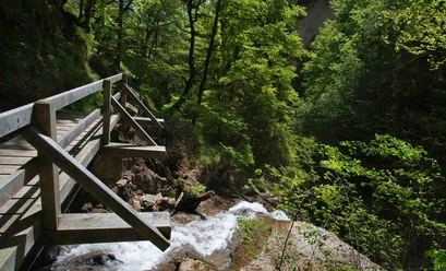
From the STI bus stop Oberhofen, Wichterheer, start steeply through the historic «Gass» and continue towards Allmend-Wallisport. A beautiful hiking trail leads over the Riderbach gorge to Mehlbaumen in Ringoldswil. At «Uf Chrinde» the path branches to the left. Over Lengg and Lengghubel – now you approach the excursion destination: the Niesenbänkli. And the view lives up to its promise: the ascent is richly rewarded with a breathtaking view over Lake Thun to the Niesen. One of the nicest moments is the well-deserved break at this spot privileged by natural beauty. Afterwards, you follow the hiking trail further in the direction of Ringoldswil, over Mattacker and Chieni. Later you reach the forest road leading to Oberhofen. At the Blochhütte you take a last rest and enjoy once again the view over the deep blue Lake Thun and the surrounding alpine panorama.

Good to know
Best to visit
- suitableDepends on weather
Directions
Oberhofen, Wichterheer bus stop – Allmend – Wallisport – Riderbach gorge – Mehlbaumen Ringoldswil – Uf Chrinde – Lengg – Lengghubel – Niesenbänkli – Mattacker - Chieni – Bloch – Oberhofen, Wichterheer bus stop.
Equipment
We recommend hiking shoes, sun and rain protection.
Directions & Parking facilities
- Getting there
By car from Bern via the A6 motorway, Thun Nord motorway exit, continue towards Gunten to the Oberhofen, Wichterheer bus stop,
ParkingPaid parking spaces in the Riderbach parking garage in Oberhofen
Public transportationFrom Thun with the STI bus line 21 to the Oberhofen, Wichterheer stop at the starting point of the route or from Thun by boat to Oberhofen (see current BLS shipping timetable Lake Thun)
License (master data)
Author´s Tip / Recommendation of the author
For grill lovers, there is the possibility to roast Cervelat at the Niesenbänkli (grillwood must be collected in the forest).
Safety guidelines
This route mostly runs on signposted paths of the Bernese hiking trails.
Nearby








Download GPX file