Picnic in the moorland paradise: Lombachalp – Möser – Widegg – Lombachalp


- 3:00 h
- 8.98 km
- 186 m
- 177 m
- 1,558 m
- 1,738 m
- 180 m
- Start: Lombachalp
- Destination: Lombachalp
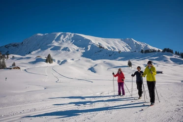
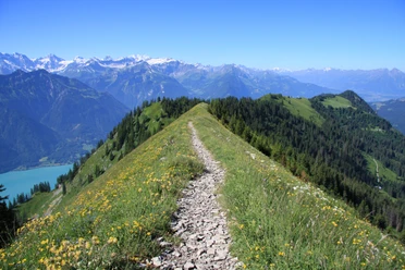
The unique idyll at the foot of the "Hohgant" can be reached as part of an easy circular hike starting from Lombachalp. The route leads almost level over "Färrich" directly to the Schwarzbach-Möser nature reserve. After the picnic stop in the middle of the moorland, the hike continues only on natural ground. From the generous barbecue area, you enjoy wonderful views of Eiger, Mönch, and Jungfrau. A wide, gravel-covered alpine path gently ascends over meadows and through small woods to "Widegg". Then it continues on a narrow path on the eastern flank of the "Bolberg" towards "Läger." Finally, you return on scenic cattle trails via "Winterröscht" back to Lombachalp.
Note(s)
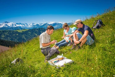
Between Hohgant and Brienzer Rothorn, there are vast high and low moors – the largest in Switzerland. There is no mass tourism on Lombachalp, but gentle recreational activities and traditional agricultural use are permitted. This is exemplified in the Schwarzbach-Möser area. This enchanting high moor is fenced off and must not be entered. Therefore, you must be content with admiring the ensemble of grasses, orchids, and individual gnarled conifer trees – which is already very enjoyable. Right next door lies a low moor grazed by cattle and mowed every two years to maintain regular plant growth. In the adjacent small forest is a generously equipped barbecue area with views to Augstmatthorn, Mönch, and Jungfrau. The unique idyll at the foot of the Hohgant was awarded the cultural landscape prize of the Oberland-Ost region in 2008.
Every year in the Oberland Ost region, particularly beautiful and valuable cultural landscapes are honored with the "Cultural Landscape Prize". Through tourism support and image promotion, the award is a small incentive for farmers to continue sustainable management, thus helping preserve our beautiful nature.
Are you looking for more hikes?
Learn more about the various hiking opportunities in the Bernese Oberland.

Good to know
Pavements
Best to visit
Directions
Directions & Parking facilities
Drive by car from Lucerne via the Brünig Pass or from Bern via the motorway and the highway via Thun-Spiez to Interlaken. You reach the junction to Habkern via Unterseen.
At the intersection in Habkern village center (bank, post office, shopping facilities), continue straight towards Schwendi. The distance from Habkern village to Lombachalp is 6 km. Parking from Schwendi/Tschieme is subject to a fee (coin-operated machine!).
Additional information
Marktgasse 1
3800 Interlaken
Phone: +41 33 826 53 00
Habkern Tourism
Im Holz 373
3804 Habkern
Tel.: +41 33 843 82 10
info@habkern.ch
www.habkern.ch
License (master data)
Author´s Tip / Recommendation of the author
Nearby
Download GPX file