To the ibex colony at Augstmatthorn


- 4:20 h
- 11.10 km
- 605 m
- 1,060 m
- 1,306 m
- 2,134 m
- 828 m
- Start: Lombachalp-Roteschwand
- Destination: Harderkulm, funicular
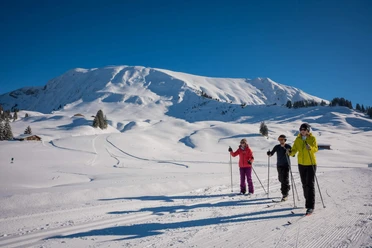
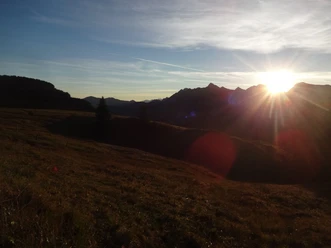
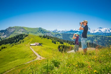
At the starting point, at the Lombachalp-Roteschwand bus stop, follow the indication Augstmatthorn. A path leads over grassland to point 2101 and shortly after to the Augstmatthorn. Some exposed sections must be overcome. The panoramic view compensates for the effort of the ascent. To the north, the view spans from the Lombachalp moorland, the source area of the Emme, to the Hohgant and the Schrattenflue. With good visibility, the Jura mountains can be seen. To the east, the upper part of Lake Brienz and the Aare plain can be made out. South to west, the ring of the Bernese Alps spreads out. With some luck, you will encounter an ibex colony. The proud animals allow an approach to within a few meters. The next part of the hike runs just below the ridge or over the narrow ridge. This promises on one hand continued breathtaking views, but on the other hand longer exposed sections or difficult to walk parts must be passed. Surefootedness and a head for heights are required. This means either walking while fully concentrating on the path or stopping to enjoy the view. The most critical spots are equipped with a rope. After the Suggiture follows a descent below the tree line, so that you now move alternately through forest or pastures further towards Harder. At Wannichnubel, a short detour to the “Chnubel” offers a view of Lake Thun. The same view is offered by the platform at the Harderkulm restaurant. A panorama board helps to name the mountain peaks. Shortly after, the destination, the mountain station of the Harder funicular, is reached.
Please observe the following behavior rules

Good to know
Pavements
Best to visit
Directions
Roteschwand - Augstmatthorn - Roteflue - Wannichnubel – Harderkulm
Equipment
We recommend the following equipment: sturdy and waterproof hiking boots, light to medium backpack, cold protection, sun protection, hiking poles, first aid kit, snacks, tea in a thermos bottle, mobile phone.
Directions & Parking facilities
Outbound: By train to Interlaken West, then by bus to Habkern, Zäundli and further to Lombachalp-Roteschwand, see also under:
https://busalpin.ch/regionen/habkern-lombachalp/sommer
Return: By funicular to Interlaken East
Additional information
Association Berner Wanderwege, Bern, Tel.: 031 340 01 01, E-mail: info@beww.ch, Homepage: www.bernerwanderwege.ch
Literature
Hiking book Panoramic hikes of the Berner Hiking Trails
License (master data)
Author´s Tip / Recommendation of the author
Arrival by Alpin bus Habkern-Lombachalp!
Safety guidelines
This route runs entirely or partially on marked trails of the mountain hiking path category
Map
Swisstopo hiking map 1:50,000 254T Interlaken
Nearby


