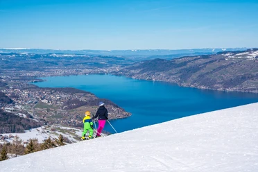
Sunny hike above Lake Thun


- 2:45 h
- 10.05 km
- 108 m
- 540 m
- 628 m
- 1,014 m
- 386 m
- Start: Aeschiried / Schoolhouse
- Destination: Spiez / Train Station
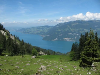
The sunny ridge of Aeschiried between Suldtal and Lake Thun is a gift from the last Ice Age. The Kander and Aare glaciers united here into a huge mass. About 10,000 years ago, when the glaciers melted, they left behind a mighty medial moraine, which today, overgrown, forested, and settled, serves as a popular excursion destination and starting point for scenic hikes. Much snow rarely lies on this sunny terrace. And even if a few flakes have fallen, this hike can still be wonderfully done. If a thick snow cover lies, winter hiking trails are prepared.
Shortly before the post bus terminus Aeschiried / Schoolhouse, the hiking trail branches off from the main road towards the forest edge, behind which the slope falls steeply to Suldtal. Along the forest edge, the path leads leisurely over meadows and pastures to the Seenegg farm. It is well known in the region that llamas and alpacas are kept here, which is why visitors often stop by the fences to admire these woolly newcomers from overseas. The route continues through the village of Aeschi and down to the Seeholzwald forest, along the forest edge to Hondrich. Through the Inforamas area, including a training center for farmers, and in a curve to the left (west), the path ascends the Hondrich hill, a wonderful viewpoint with benches. Inside the Hondrich hill is a fortress from the Second World War; the former artillery installation can be visited on guided tours. Another highlight on the hill is the impressive glacial erratic, not far from the highest point and slightly north below the hiking trail.
On the other side of the Hondrich hill, the path then descends to Spiez, winding through the neighborhoods to the train station.
Text: Sabine and Fredy Joss

Good to know
Pavements
Best to visit
Directions
Aeschiried – Aeschi near Spiez – Hondrich – Hondrich hill – Spiez
Equipment
We recommend the following equipment: light trekking shoes, light backpack, sun protection, rain jacket, small first aid kit, light picnic, sufficient fluids, mobile phone.
Directions & Parking facilities
Arrival: by post bus from Spiez train station to Aeschiried / Schoolhouse
Return: by train from Spiez
Additional information
Berner Wanderwege, 031 340 01 01, info@beww.ch, bernerwanderwege.ch
License (master data)
Safety guidelines
This route runs exclusively on signposted paths of the hiking trail category.
Map
swisstopo hiking maps: 253T Gantrisch and 254T Interlaken, 1 : 50 000
Nearby

")

