- 4:00 h
- 10.29 km
- 760 m
- 760 m
- 1,394 m
- 2,026 m
- 632 m
- Start: Griesalp
- Destination: Griesalp
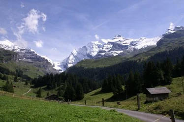
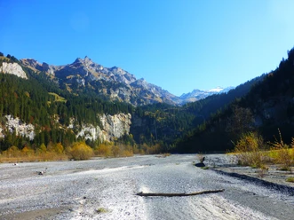
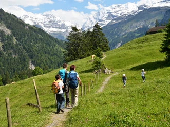
From the bus terminus Griesalp, one alternately follows narrow mountain paths and gravel roads used for alpine farming to the Dünde-Mittelberg and from there further over the Underi to the Oberi Bundalp. The barren landscape displays a rugged charm: wide scree slopes and rock bands shape its face, with cattle grazing on extensive alpine pastures in between. With a considerably gentler ascent, you reach the Bundläger and finally the Oberloch, where the scenery suddenly changes: Behind a hilltop, the wide terrain basin of Gamchi opens up. The thin grass cover is interspersed with broad debris cones from several mountain streams. The magnificent landscape offers delightful silence and wonderful views. At the valley end, the Gamchi glacier appears and above it, between the Gspaltenhorn and the Blüemlisalp massif, the sharply cut Gamchilücke. A narrow but not too steep mountain path leads down to the Gamchi hut in the valley floor, then goes uphill above the Gamchi stream downstream to Bürgli. Impressive rock formations testify to the primeval forces to which the rock was subjected during the Alpine folding. Above the Bundstäg, instead of the alpine road, the path leading down to the Gamchi stream is chosen; however, it stays on the right side of the stream and reaches again at Steineberg the small road leading to Golderli. From there, it is a few minutes back to Griesalp.

Pavements
- Trail (30%)Path (61%)Asphalt (9%)
Best to visit
- suitableDepends on weather
Directions
- Griesalp - Bundalp - Gamchi - Golderli - Griesalp
Equipment
- We recommend the following equipment: sturdy mountain boots, medium-sized backpack with hip belt, sun protection, rain gear, hiking poles, first aid kit, picnic, sufficient fluids, mobile phone.
Additional information
- Association Berner Wanderwege, Bern, Tel.: 031 340 01 01, E-mail: info@beww.ch, homepage: www.bernerwanderwege.ch
Literature
Hiking suggestion from the hiking book Thunersee - Frutigland, hiking book series of the Berner Wanderwege
License (master data)
Safety guidelines
- This route runs fully or partially on mountain hiking trails.
Map
Swisstopo hiking map 1:50,000 264T Jungfrau